
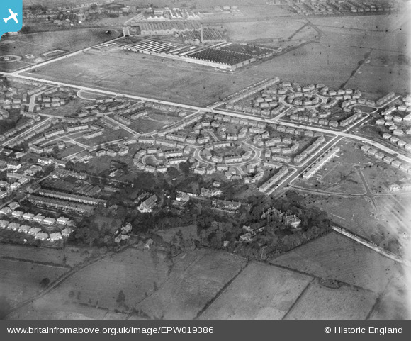
EPW019386 ENGLAND (1927). Western Circle, Burnage, 1927
© Copyright OpenStreetMap contributors and licensed by the OpenStreetMap Foundation. 2026. Cartography is licensed as CC BY-SA.
Nearby Images (12)
EPW019386

EPW019125

EPW019128

EPW019123

EPW019392

EPW019388

EPW019393

EPW019394

EPW019390

EPW019126

EPW019124

EPW019387

Details
| Title | [EPW019386] Western Circle, Burnage, 1927 |
| Reference | EPW019386 |
| Date | 30-September-1927 |
| Link | |
| Place name | BURNAGE |
| Parish | |
| District | |
| Country | ENGLAND |
| Easting / Northing | 386862, 392678 |
| Longitude / Latitude | -2.197758548081, 53.430467036417 |
| National Grid Reference | SJ869927 |
Pins

DreamReiver |
Saturday 3rd of September 2016 03:57:52 PM | |
|
John Ellis |
Monday 27th of August 2012 06:20:43 PM | |
|
John Ellis |
Monday 27th of August 2012 06:15:06 PM | |
|
John Ellis |
Monday 27th of August 2012 06:14:09 PM | |
|
John Ellis |
Monday 27th of August 2012 06:13:37 PM | |
|
John Ellis |
Monday 27th of August 2012 06:12:43 PM | |
|
John Ellis |
Monday 27th of August 2012 06:11:53 PM | |
|
John Ellis |
Monday 27th of August 2012 06:11:25 PM | |
|
John Ellis |
Monday 27th of August 2012 06:10:47 PM | |
|
John Ellis |
Monday 27th of August 2012 06:09:55 PM | |
|
John Ellis |
Monday 27th of August 2012 06:08:40 PM | |
|
John Ellis |
Monday 27th of August 2012 06:08:14 PM | |
|
John Ellis |
Monday 27th of August 2012 06:07:46 PM | |
|
John Ellis |
Monday 27th of August 2012 06:07:25 PM | |
|
John Ellis |
Monday 27th of August 2012 06:07:02 PM | |
|
John Ellis |
Monday 27th of August 2012 06:06:40 PM | |
|
John Ellis |
Monday 27th of August 2012 06:06:08 PM | |
|
John Ellis |
Monday 27th of August 2012 06:05:38 PM | |
|
John Ellis |
Monday 27th of August 2012 06:04:33 PM | |
|
John Ellis |
Monday 27th of August 2012 06:03:30 PM | |
|
John Ellis |
Monday 27th of August 2012 06:02:52 PM | |
|
John Ellis |
Monday 27th of August 2012 06:02:07 PM |