
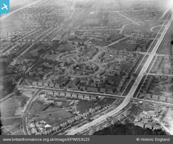
EPW019123 ENGLAND (1927). Western Circle and environs, Burnage, 1927
© Copyright OpenStreetMap contributors and licensed by the OpenStreetMap Foundation. 2026. Cartography is licensed as CC BY-SA.
Nearby Images (12)
EPW019123

EPW019125

EPW019128

EPW019388

EPW019386

EPW019392

EPW019393

EPW019394

EPW019390

EPW019126

EPW019124

EPW019387

Details
| Title | [EPW019123] Western Circle and environs, Burnage, 1927 |
| Reference | EPW019123 |
| Date | 4-August-1927 |
| Link | |
| Place name | BURNAGE |
| Parish | |
| District | |
| Country | ENGLAND |
| Easting / Northing | 386902, 392669 |
| Longitude / Latitude | -2.1971560812535, 53.430387126059 |
| National Grid Reference | SJ869927 |
Pins

Crofter56 |
Sunday 22nd of March 2020 09:02:53 AM | |
|
DreamReiver |
Saturday 3rd of September 2016 03:45:41 PM | |
|
TheBlueCube |
Monday 19th of November 2012 01:19:56 AM | |
|
TheBlueCube |
Monday 19th of November 2012 01:19:02 AM | |
|
TheBlueCube |
Monday 19th of November 2012 01:18:33 AM | |
|
Steve Delves |
Saturday 29th of September 2012 11:12:10 PM |