
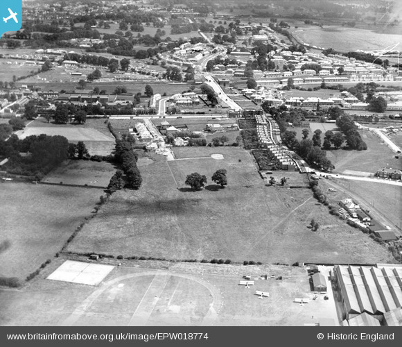
EPW018774 ENGLAND (1927). Construction of the Watling Estate, Edgware, 1927
© Copyright OpenStreetMap contributors and licensed by the OpenStreetMap Foundation. 2026. Cartography is licensed as CC BY-SA.
Nearby Images (30)
EPW018774

EPW018771

EPW018773

EPW018767

EPW022362

EPW018772

EPW017583

EPW034799

EPW015848

EPW018768

EPW018769

EPW017584

EPW015845

EPW015850

EPW015851

EPW015849

EPW018766

EPW015847

EPW018770

EPW015852

EPW031546

EPW032891

EPW030056

EPW025691

EPW046487

EPW047555

EPW025073

EPW030057

EPW019193

EPW022364

Details
| Title | [EPW018774] Construction of the Watling Estate, Edgware, 1927 |
| Reference | EPW018774 |
| Date | 8-July-1927 |
| Link | |
| Place name | EDGWARE |
| Parish | |
| District | |
| Country | ENGLAND |
| Easting / Northing | 519844, 190397 |
| Longitude / Latitude | -0.26947402392943, 51.599177040384 |
| National Grid Reference | TQ198904 |
