
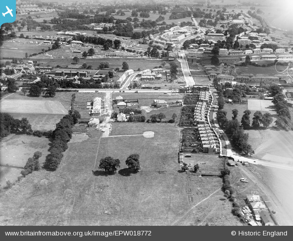
EPW018772 ENGLAND (1927). Construction of the Watling Estate, Edgware, 1927
© Copyright OpenStreetMap contributors and licensed by the OpenStreetMap Foundation. 2026. Cartography is licensed as CC BY-SA.
Nearby Images (21)
EPW018772

EPW018769

EPW018766

EPW018768

EPW017584

EPW018771

EPW018767

EPW018773

EPW018774

EPW017583

EPW019193

EPW019191

EPW034799

EPW022362

EPW001350

EPW015848

EPW015849

EPW015850

EPW015851

EPW015845

EPW015847

Details
| Title | [EPW018772] Construction of the Watling Estate, Edgware, 1927 |
| Reference | EPW018772 |
| Date | 8-July-1927 |
| Link | |
| Place name | EDGWARE |
| Parish | |
| District | |
| Country | ENGLAND |
| Easting / Northing | 519941, 190474 |
| Longitude / Latitude | -0.26804771528213, 51.599848483528 |
| National Grid Reference | TQ199905 |
Pins

The Laird |
Wednesday 18th of April 2018 02:43:10 PM | |
|
Mark Amies |
Monday 11th of August 2014 05:35:48 PM | |

Class31 |
Friday 7th of September 2012 09:28:12 PM | |
|
Class31 |
Friday 7th of September 2012 09:27:43 PM |