
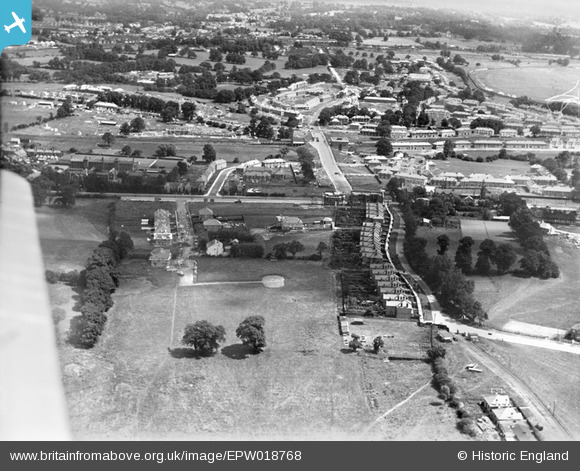
EPW018768 ENGLAND (1927). Construction of the Watling Estate, Edgware, 1927
© Copyright OpenStreetMap contributors and licensed by the OpenStreetMap Foundation. 2026. Cartography is licensed as CC BY-SA.
Nearby Images (17)
EPW018768

EPW018769

EPW017584

EPW018766

EPW018772

EPW017583

EPW018771

EPW018773

EPW018774

EPW018767

EPW019193

EPW019191

EAW020696

EPW001350

EPW022362

EPW015848

EPW015849

Details
| Title | [EPW018768] Construction of the Watling Estate, Edgware, 1927 |
| Reference | EPW018768 |
| Date | 8-July-1927 |
| Link | |
| Place name | EDGWARE |
| Parish | |
| District | |
| Country | ENGLAND |
| Easting / Northing | 519982, 190472 |
| Longitude / Latitude | -0.2674566494847, 51.599821772833 |
| National Grid Reference | TQ200905 |
Pins

Jim Rea |
Monday 27th of August 2012 02:30:23 PM | |
|
Jim Rea |
Monday 27th of August 2012 02:27:32 PM | |
|
Jim Rea |
Monday 27th of August 2012 02:24:08 PM | |
|
Jim Rea |
Monday 27th of August 2012 02:20:40 PM | |
|
Jim Rea |
Monday 27th of August 2012 02:16:01 PM | |
|
Jim Rea |
Monday 27th of August 2012 02:13:20 PM | |
|
Jim Rea |
Monday 27th of August 2012 02:09:58 PM | |

Class31 |
Friday 24th of August 2012 10:29:40 PM | |
|
Class31 |
Friday 24th of August 2012 10:28:24 PM | |
|
Class31 |
Wednesday 22nd of August 2012 09:45:18 AM |