
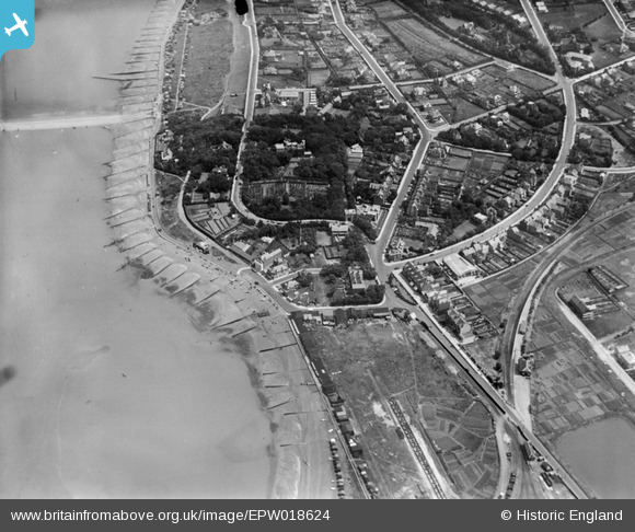
EPW018624 ENGLAND (1927). Tankerton Castle and environs, Whitstable, 1927
© Copyright OpenStreetMap contributors and licensed by the OpenStreetMap Foundation. 2026. Cartography is licensed as CC BY-SA.
Nearby Images (3)
EPW018624

EPW035504

EPW009155

Details
| Title | [EPW018624] Tankerton Castle and environs, Whitstable, 1927 |
| Reference | EPW018624 |
| Date | 22-June-1927 |
| Link | |
| Place name | WHITSTABLE |
| Parish | |
| District | |
| Country | ENGLAND |
| Easting / Northing | 611214, 167142 |
| Longitude / Latitude | 1.0344201282782, 51.363508620352 |
| National Grid Reference | TR112671 |
Pins

Sparky |
Friday 29th of December 2017 11:35:01 PM | |

PaulCT5 |
Saturday 10th of October 2015 01:38:15 PM | |
|
J B Pearse |
Sunday 6th of January 2013 11:57:26 AM | |
|
J B Pearse |
Sunday 6th of January 2013 11:50:11 AM |
User Comment Contributions

Tankerton Castle |
Robert - Cumbria |
Wednesday 27th of June 2012 06:27:39 PM |