
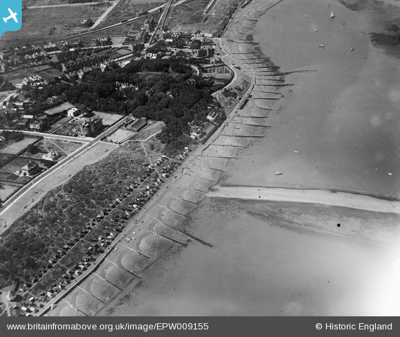
EPW009155 ENGLAND (1923). Tower Hill, Whitstable, 1923
© Copyright OpenStreetMap contributors and licensed by the OpenStreetMap Foundation. 2026. Cartography is licensed as CC BY-SA.
Nearby Images (4)
EPW009155

EPW000653
 and environs, Whitstable, from the east, 1920. This image has been produced from a print.")
EPW018622

EPW018624

Details
| Title | [EPW009155] Tower Hill, Whitstable, 1923 |
| Reference | EPW009155 |
| Date | 1923 |
| Link | |
| Place name | WHITSTABLE |
| Parish | |
| District | |
| Country | ENGLAND |
| Easting / Northing | 611437, 167331 |
| Longitude / Latitude | 1.037731427334, 51.36512288818 |
| National Grid Reference | TR114673 |
Pins

Sparky |
Friday 29th of December 2017 11:57:44 PM | |
|
Sparky |
Sunday 13th of August 2017 12:54:39 PM | |
|
Sparky |
Sunday 13th of August 2017 12:54:19 PM | |
|
Sparky |
Sunday 13th of August 2017 12:53:25 PM | |
|
Sparky |
Sunday 13th of August 2017 12:52:38 PM | |
|
Sparky |
Sunday 13th of August 2017 12:52:13 PM | |
|
Sparky |
Sunday 13th of August 2017 12:52:12 PM | |
|
Sparky |
Sunday 13th of August 2017 12:51:52 PM | |
|
Sparky |
Sunday 13th of August 2017 12:51:52 PM | |
|
Sparky |
Sunday 13th of August 2017 12:50:56 PM |