
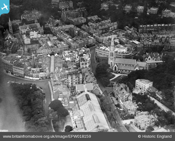
EPW018159 ENGLAND (1927). St Peter's Church and environs, Bournemouth, 1927. This image has been produced from a copy-negative.
© Copyright OpenStreetMap contributors and licensed by the OpenStreetMap Foundation. 2026. Cartography is licensed as CC BY-SA.
Nearby Images (6)
EPW018159

EPR000282

EPR000284

EPW018161

EPW037420

EPW041045

Details
| Title | [EPW018159] St Peter's Church and environs, Bournemouth, 1927. This image has been produced from a copy-negative. |
| Reference | EPW018159 |
| Date | 5-June-1927 |
| Link | |
| Place name | BOURNEMOUTH |
| Parish | |
| District | |
| Country | ENGLAND |
| Easting / Northing | 408831, 91195 |
| Longitude / Latitude | -1.8748879022686, 50.71974020696 |
| National Grid Reference | SZ088912 |
Pins
Be the first to add a comment to this image!