
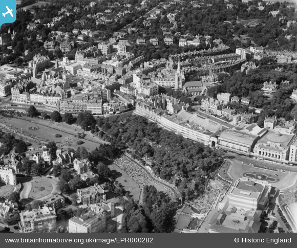
EPR000282 ENGLAND (1934). The Lower Pleasure Gardens, Westover Road and environs, Bournemouth, 1934
© Copyright OpenStreetMap contributors and licensed by the OpenStreetMap Foundation. 2026. Cartography is licensed as CC BY-SA.
Nearby Images (8)
EPR000282

EPW018159

EPR000284

EPW018161

EPW037420

EPW041045

EPW013563

EPR000663

Details
| Title | [EPR000282] The Lower Pleasure Gardens, Westover Road and environs, Bournemouth, 1934 |
| Reference | EPR000282 |
| Date | 26-August-1934 |
| Link | |
| Place name | BOURNEMOUTH |
| Parish | |
| District | |
| Country | ENGLAND |
| Easting / Northing | 408816, 91123 |
| Longitude / Latitude | -1.8751021335473, 50.719092889208 |
| National Grid Reference | SZ088911 |
Pins

Class31 |
Saturday 17th of October 2015 11:30:56 PM |
