
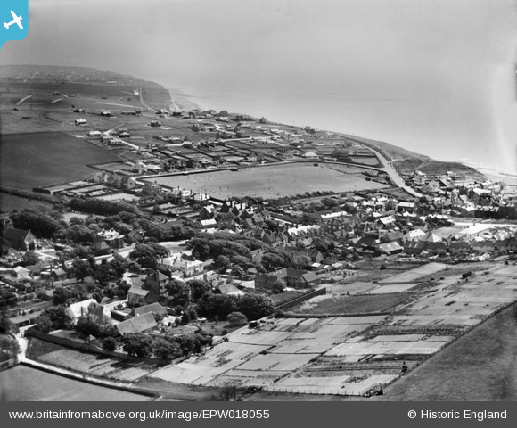
EPW018055 ENGLAND (1927). St Aubyns School playing field and environs, Rottingdean, from the north-west, 1927
© Copyright OpenStreetMap contributors and licensed by the OpenStreetMap Foundation. 2026. Cartography is licensed as CC BY-SA.
Nearby Images (37)
EPW018055

EPW018058

EPW018061

EPW041382

EPW018057

EPW054006

EPW054005

EPW017267

EPW035299

EPW054004

EPW018056

EPW018059

EPW017726

EPW018064

EPW017270

EPW054008

EPW054009

EPW054012

EPW054011

EPW054010

EPW054003

EPW054007

EPW017266

EPW018054

EPW017265

EPW017263

EPW017731

EPW035302

EPW017268

EPW035300

EPW017264

EPW018063

EPW017269

EPW054058

EPW017733

EPW018060

EPW042967

Details
| Title | [EPW018055] St Aubyns School playing field and environs, Rottingdean, from the north-west, 1927 |
| Reference | EPW018055 |
| Date | May-1927 |
| Link | |
| Place name | ROTTINGDEAN |
| Parish | ROTTINGDEAN |
| District | |
| Country | ENGLAND |
| Easting / Northing | 536900, 102443 |
| Longitude / Latitude | -0.056893094860468, 50.80478485244 |
| National Grid Reference | TQ369024 |
Pins
Be the first to add a comment to this image!