
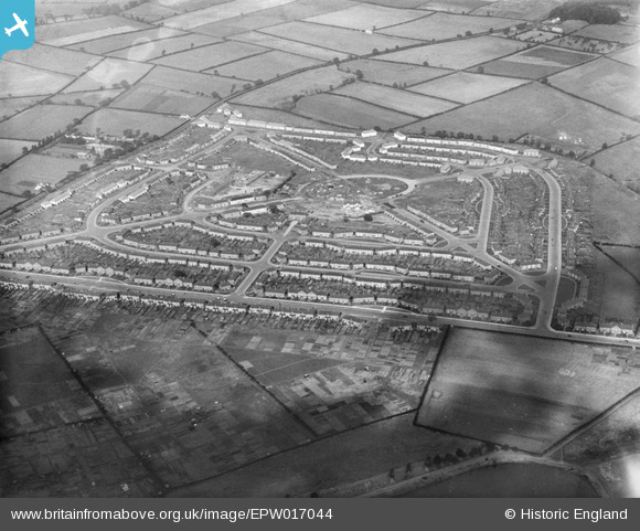
EPW017044 ENGLAND (1926). Housing around The Circle and Witton Lodge Road, Perry Common, 1926
© Copyright OpenStreetMap contributors and licensed by the OpenStreetMap Foundation. 2026. Cartography is licensed as CC BY-SA.
Nearby Images (4)
EPW017044

EPW017042

EPW017043

EPW017949

Details
| Title | [EPW017044] Housing around The Circle and Witton Lodge Road, Perry Common, 1926 |
| Reference | EPW017044 |
| Date | 6-October-1926 |
| Link | |
| Place name | PERRY COMMON |
| Parish | |
| District | |
| Country | ENGLAND |
| Easting / Northing | 409035, 293034 |
| Longitude / Latitude | -1.8667856465519, 52.534731886713 |
| National Grid Reference | SP090930 |
Pins

ItsTHEBullring |
Monday 2nd of July 2012 04:14:02 PM | |
|
ItsTHEBullring |
Monday 2nd of July 2012 04:11:13 PM | |
|
ItsTHEBullring |
Monday 2nd of July 2012 03:53:59 PM | |
|
ItsTHEBullring |
Monday 2nd of July 2012 03:53:30 PM | |
|
ItsTHEBullring |
Monday 2nd of July 2012 03:52:51 PM | |
|
ItsTHEBullring |
Monday 2nd of July 2012 03:52:11 PM | |
|
ItsTHEBullring |
Monday 2nd of July 2012 03:51:41 PM | |
|
ItsTHEBullring |
Monday 2nd of July 2012 03:51:12 PM | |
|
ItsTHEBullring |
Monday 2nd of July 2012 03:50:34 PM | |
|
ItsTHEBullring |
Monday 2nd of July 2012 03:50:09 PM | |
|
ItsTHEBullring |
Monday 2nd of July 2012 03:49:39 PM | |
|
ItsTHEBullring |
Monday 2nd of July 2012 03:49:06 PM | |
|
Jayne |
Sunday 1st of July 2012 09:54:44 PM | |
|
Jayne |
Sunday 1st of July 2012 09:54:03 PM |