
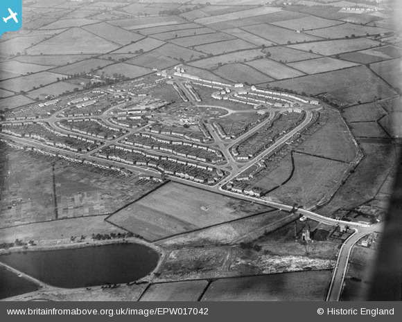
EPW017042 ENGLAND (1926). Housing around The Circle and Witton Lodge Road, Perry Common, 1926
© Copyright OpenStreetMap contributors and licensed by the OpenStreetMap Foundation. 2026. Cartography is licensed as CC BY-SA.
Nearby Images (3)
EPW017042

EPW017949

EPW017044

Details
| Title | [EPW017042] Housing around The Circle and Witton Lodge Road, Perry Common, 1926 |
| Reference | EPW017042 |
| Date | 6-October-1926 |
| Link | |
| Place name | PERRY COMMON |
| Parish | |
| District | |
| Country | ENGLAND |
| Easting / Northing | 409165, 292967 |
| Longitude / Latitude | -1.8648707482487, 52.534127323943 |
| National Grid Reference | SP092930 |
Pins

ItsTHEBullring |
Monday 2nd of July 2012 04:15:58 PM | |
|
Jayne |
Wednesday 27th of June 2012 09:36:50 PM | |
|
Jayne |
Wednesday 27th of June 2012 09:35:38 PM | |
|
Jayne |
Wednesday 27th of June 2012 09:34:55 PM | |
|
Jayne |
Wednesday 27th of June 2012 09:33:57 PM | |
|
Jayne |
Wednesday 27th of June 2012 09:33:24 PM | |
|
Jayne |
Wednesday 27th of June 2012 09:32:41 PM |