
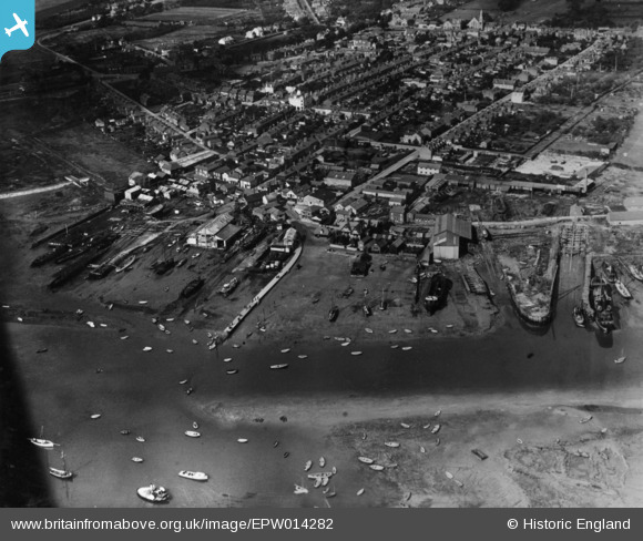
EPW014282 ENGLAND (1925). The wharf and the town, Brightlingsea, 1925. This image has been produced from a print.
© Copyright OpenStreetMap contributors and licensed by the OpenStreetMap Foundation. 2026. Cartography is licensed as CC BY-SA.
Nearby Images (13)
EPW014282

EPW014285

EPW041414

EAW024664

EPW041412

EPW041410

EAW049471

EAW049470

EPW014283

EAW024663

EAW049472

EPW041411

EAW049473

Details
| Title | [EPW014282] The wharf and the town, Brightlingsea, 1925. This image has been produced from a print. |
| Reference | EPW014282 |
| Date | September-1925 |
| Link | |
| Place name | BRIGHTLINGSEA |
| Parish | BRIGHTLINGSEA |
| District | |
| Country | ENGLAND |
| Easting / Northing | 608586, 216187 |
| Longitude / Latitude | 1.025860662205, 51.804901339211 |
| National Grid Reference | TM086162 |
Pins
Be the first to add a comment to this image!