
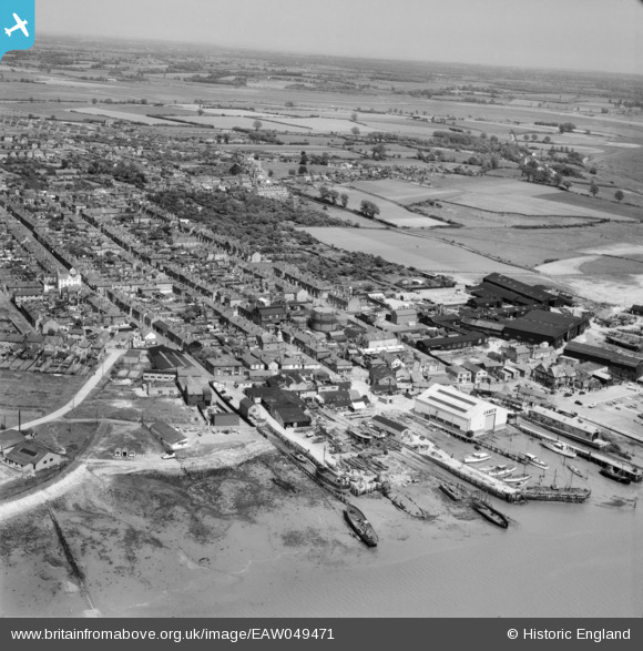
EAW049471 ENGLAND (1953). The waterfront and town, Brightlingsea, from the west, 1953
© Copyright OpenStreetMap contributors and licensed by the OpenStreetMap Foundation. 2026. Cartography is licensed as CC BY-SA.
Nearby Images (13)
EAW049471

EAW049470

EPW041412

EPW041414

EPW014283

EPW014285

EPW041410

EPW014282

EAW024663

EAW024664

EAW049472

EPW041411

EAW049473

Details
| Title | [EAW049471] The waterfront and town, Brightlingsea, from the west, 1953 |
| Reference | EAW049471 |
| Date | 19-May-1953 |
| Link | |
| Place name | BRIGHTLINGSEA |
| Parish | BRIGHTLINGSEA |
| District | |
| Country | ENGLAND |
| Easting / Northing | 608466, 216208 |
| Longitude / Latitude | 1.024135124031, 51.805134660823 |
| National Grid Reference | TM085162 |
Pins

Paul S |
Friday 8th of August 2014 01:43:36 PM |