
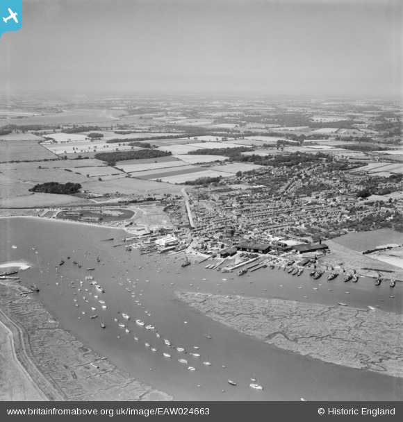
EAW024663 ENGLAND (1949). Brightlingsea Creek, the waterfront and town, Brightlingsea, from the south-east, 1949
© Copyright OpenStreetMap contributors and licensed by the OpenStreetMap Foundation. 2026. Cartography is licensed as CC BY-SA.
Nearby Images (13)
EAW024663

EAW049472

EPW041411

EAW049473

EAW024664

EPW014282

EPW014285

EPW041414

EAW049471

EPW041412

EAW049470

EPW041410

EPW014283

Details
| Title | [EAW024663] Brightlingsea Creek, the waterfront and town, Brightlingsea, from the south-east, 1949 |
| Reference | EAW024663 |
| Date | 11-July-1949 |
| Link | |
| Place name | BRIGHTLINGSEA |
| Parish | BRIGHTLINGSEA |
| District | |
| Country | ENGLAND |
| Easting / Northing | 608604, 216054 |
| Longitude / Latitude | 1.0260413504966, 51.803700352106 |
| National Grid Reference | TM086161 |
Pins

ken |
Thursday 30th of July 2015 03:12:35 PM |