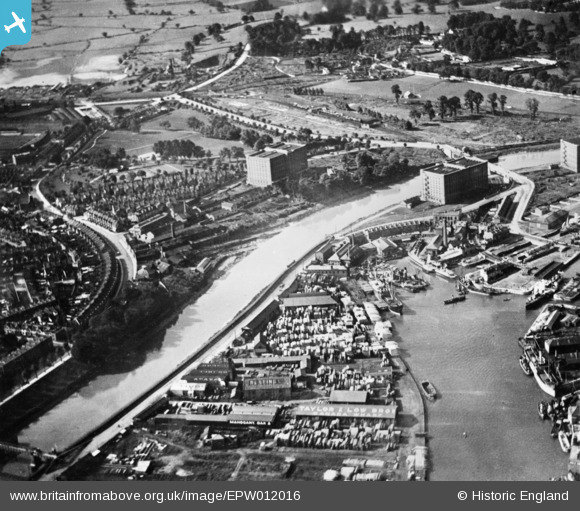
EPW012016 ENGLAND (1924). The River Avon at Ashton Gate, Bristol, 1924. This image has been produced from a copy-negative.
    © Copyright OpenStreetMap contributors and licensed by the OpenStreetMap Foundation. 2025. Cartography is licensed as CC BY-SA.
  
Nearby Images (7)
Details
| Title | [EPW012016] The River Avon at Ashton Gate, Bristol, 1924. This image has been produced from a copy-negative. | 
| Reference | EPW012016 | 
| Date | October-1924 | 
| Link | |
| Place name | BRISTOL | 
| Parish | |
| District | |
| Country | ENGLAND | 
| Easting / Northing | 357300, 172058 | 
| Longitude / Latitude | -2.61448867545, 51.445410029769 | 
| National Grid Reference | ST573721 | 
Pins
|  Harbour railway branch swing bridge opened for vessel entering Floating Harbour at high tide. The tidal Avon and the locks at the Cumberland Basin restricted vessels to less than 330-350 feet in length |   MB | Saturday 3rd of September 2016 01:56:30 PM | 
|  New Cut at high tide |   MB | Saturday 3rd of September 2016 01:53:31 PM | 
|  Taylor and Low Bros, Canada Wharf |   MB | Saturday 3rd of September 2016 01:53:02 PM | 
|  Clift House Tannery - certainly active 1880-1900 |   MB | Saturday 3rd of September 2016 01:52:07 PM | 
|  Vauxhall Yard. Shipbuilding site |   MB | Saturday 3rd of September 2016 01:50:56 PM | 
|  Ashton Vale Works. Brick and Coke. Claypit here |   MB | Saturday 3rd of September 2016 01:49:39 PM | 
|  The Underfall Yard |   Kevdrev | Wednesday 27th of April 2016 02:58:43 AM | 
|  Bristol City FC, Ashton Gate |   Kevdrev | Wednesday 27th of April 2016 02:56:57 AM | 
 
             
  ![[EPW012016] The River Avon at Ashton Gate, Bristol, 1924. This image has been produced from a copy-negative.](http://britainfromabove.org.uk/sites/all/libraries/aerofilms-images/public/100x100/EPW/012/EPW012016.jpg) 
  
                                          ![[EPW012015] Timber yards at Baltic Wharf on the Floating Harbour, Bristol, 1924. This image has been produced from a copy-negative affected by flare.](http://britainfromabove.org.uk/sites/all/libraries/aerofilms-images/public/100x100/EPW/012/EPW012015.jpg) 
 ![[EPW005470] The timber yards at Baltic Wharf, Canada Wharf and Cumberland Wharf, Bristol, 1921](http://britainfromabove.org.uk/sites/all/libraries/aerofilms-images/public/100x100/EPW/005/EPW005470.jpg) 
 ![[EPW033497] The Underfall Yard and Cumberland Basin, Bristol, 1930](http://britainfromabove.org.uk/sites/all/libraries/aerofilms-images/public/100x100/EPW/033/EPW033497.jpg) 
 ![[EAW002051] Cumberland Basin and the Floating Harbour, Bristol, 1946. This image has been produced from a print.](http://britainfromabove.org.uk/sites/all/libraries/aerofilms-images/public/100x100/EAW/002/EAW002051.jpg) 
 ![[EPW032528] Greville Smyth Park, the Cumberland Basin and Clifton, Bristol, from the south, 1930](http://britainfromabove.org.uk/sites/all/libraries/aerofilms-images/public/100x100/EPW/032/EPW032528.jpg) 
 ![[EAW033326] The Cumberland Basin, Floating Harbour and River Avon, Bristol, 1950. This image was marked by Aerofilms Ltd for photo editing.](http://britainfromabove.org.uk/sites/all/libraries/aerofilms-images/public/100x100/EAW/033/EAW033326.jpg)