
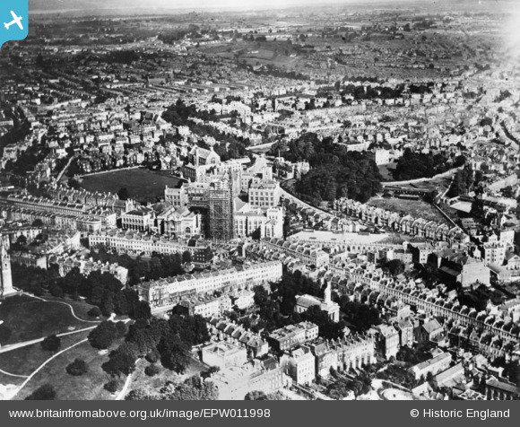
EPW011998 ENGLAND (1924). The Wills Memorial Building under construction, Bristol, 1924. This image has been produced from a copy-negative.
© Copyright OpenStreetMap contributors and licensed by the OpenStreetMap Foundation. 2026. Cartography is licensed as CC BY-SA.
Nearby Images (22)
EPW011998

EPW033150

EAW000736

EPW033151

EPW022271

EPW033148

EPW022270

EAW000735

EPW033149

EPW041482

EPW047091

EAW015782

EAW015781

EAW015783

EPW005469

EAW000734

EAW015779

EAW050557

EAW000733

EPW022275

EPW047092

EAW015784

Details
| Title | [EPW011998] The Wills Memorial Building under construction, Bristol, 1924. This image has been produced from a copy-negative. |
| Reference | EPW011998 |
| Date | September-1924 |
| Link | |
| Place name | BRISTOL |
| Parish | |
| District | |
| Country | ENGLAND |
| Easting / Northing | 358132, 173231 |
| Longitude / Latitude | -2.6026550761911, 51.456019883032 |
| National Grid Reference | ST581732 |
