
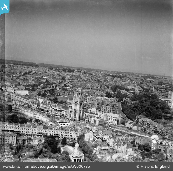
EAW000735 ENGLAND (1946). The Wills Memorial Building and environs, Bristol, from the south, 1946
© Copyright OpenStreetMap contributors and licensed by the OpenStreetMap Foundation. 2026. Cartography is licensed as CC BY-SA.
Nearby Images (20)
EAW000735

EAW000736

EPW033150

EPW033149

EPW011998

EPW041482

EPW022271

EPW005469

EAW000734

EPW033151

EPW033148

EAW000733

EPW022270

EAW015783

EAW015779

EAW015782

EPW047092

EPW047091

EAW015784

EAW015781

Details
| Title | [EAW000735] The Wills Memorial Building and environs, Bristol, from the south, 1946 |
| Reference | EAW000735 |
| Date | 9-May-1946 |
| Link | |
| Place name | BRISTOL |
| Parish | |
| District | |
| Country | ENGLAND |
| Easting / Northing | 358106, 173309 |
| Longitude / Latitude | -2.6030385445025, 51.456719340905 |
| National Grid Reference | ST581733 |
Pins

Frank |
Sunday 11th of August 2024 10:34:45 AM | |
|
Frank |
Sunday 11th of August 2024 09:41:55 AM | |
|
Hugh Madgin |
Monday 14th of October 2013 07:33:05 PM |