
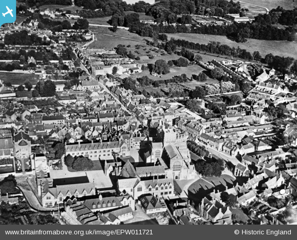
EPW011721 ENGLAND (1924). The town centre, Sherborne, 1924. This image has been produced from a copy-negative.
© Copyright OpenStreetMap contributors and licensed by the OpenStreetMap Foundation. 2026. Cartography is licensed as CC BY-SA.
Nearby Images (17)
EPW011721

EAW033659

EPW023213

EAW033660

EPW023205

EPW054747

EPW011720

EPW023206

EAW033658

EAW033657

EPW054741

EPW054742

EPW054748

EPW054745

EPW054746

EPW054744

EPW054743

Details
| Title | [EPW011721] The town centre, Sherborne, 1924. This image has been produced from a copy-negative. |
| Reference | EPW011721 |
| Date | 8-September-1924 |
| Link | |
| Place name | SHERBORNE |
| Parish | SHERBORNE |
| District | |
| Country | ENGLAND |
| Easting / Northing | 363933, 116515 |
| Longitude / Latitude | -2.5134568043644, 50.946394942566 |
| National Grid Reference | ST639165 |
Pins
Be the first to add a comment to this image!