
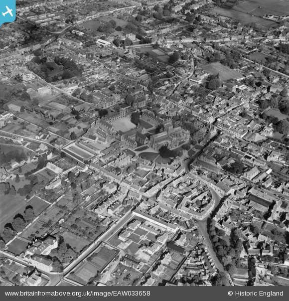
EAW033658 ENGLAND (1950). Sherborne School and the town, Sherborne, 1950
© Copyright OpenStreetMap contributors and licensed by the OpenStreetMap Foundation. 2026. Cartography is licensed as CC BY-SA.
Nearby Images (11)
EAW033658

EPW023206

EAW033657

EPW054747

EPW023205

EPW023213

EAW033660

EPW011720

EAW033659

EPW011721

EPW023207

Details
| Title | [EAW033658] Sherborne School and the town, Sherborne, 1950 |
| Reference | EAW033658 |
| Date | 12-October-1950 |
| Link | |
| Place name | SHERBORNE |
| Parish | SHERBORNE |
| District | |
| Country | ENGLAND |
| Easting / Northing | 363763, 116496 |
| Longitude / Latitude | -2.5158749614748, 50.946213411133 |
| National Grid Reference | ST638165 |
Pins
Be the first to add a comment to this image!