
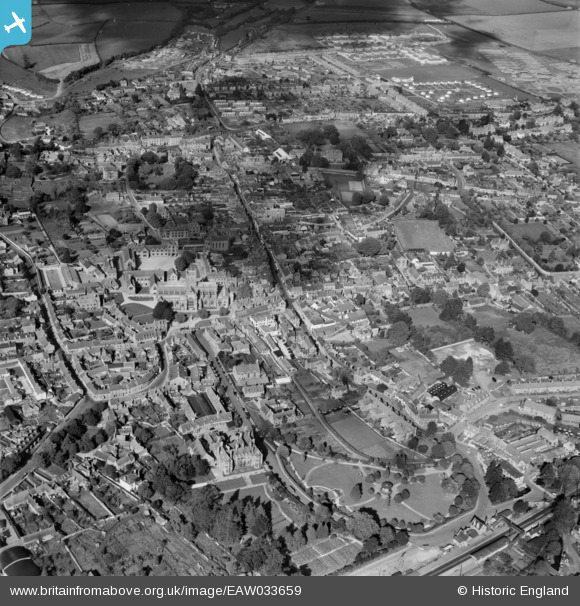
EAW033659 ENGLAND (1950). The town, Sherborne, 1950
© Copyright OpenStreetMap contributors and licensed by the OpenStreetMap Foundation. 2026. Cartography is licensed as CC BY-SA.
Nearby Images (16)
EAW033659

EPW011721

EAW033660

EPW023205

EPW011720

EPW023213

EPW054747

EPW023206

EAW033658

EAW033657

EPW054741

EPW054742

EPW054745

EPW054746

EPW054743

EPW054744

Details
| Title | [EAW033659] The town, Sherborne, 1950 |
| Reference | EAW033659 |
| Date | 12-October-1950 |
| Link | |
| Place name | SHERBORNE |
| Parish | SHERBORNE |
| District | |
| Country | ENGLAND |
| Easting / Northing | 363895, 116534 |
| Longitude / Latitude | -2.5139996407838, 50.946563430025 |
| National Grid Reference | ST639165 |
Pins

alastair wallace |
Sunday 20th of December 2015 11:30:04 PM | |
|
alastair wallace |
Sunday 20th of December 2015 11:27:11 PM | |
|
Tink |
Thursday 4th of September 2014 02:54:59 PM | |
|
Tink |
Thursday 4th of September 2014 02:53:35 PM |