
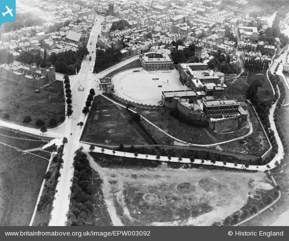
EPW003092 ENGLAND (1920). Chester Castle, Chester, 1920
© Copyright OpenStreetMap contributors and licensed by the OpenStreetMap Foundation. 2026. Cartography is licensed as CC BY-SA.
Nearby Images (12)
EPW003092

EPW004001

EPW003087

EPW029882

EAW013774

EAW013775

EPW036916

EAW013773

EPW058005

EPW058008

EPW003088

EPW011201

Details
| Title | [EPW003092] Chester Castle, Chester, 1920 |
| Reference | EPW003092 |
| Date | July-1920 |
| Link | |
| Place name | CHESTER |
| Parish | CHESTER CASTLE |
| District | |
| Country | ENGLAND |
| Easting / Northing | 340403, 365778 |
| Longitude / Latitude | -2.8919671743408, 53.18546764041 |
| National Grid Reference | SJ404658 |
Pins

BigChes |
Monday 4th of November 2013 08:30:30 PM | |
|
BigChes |
Monday 4th of November 2013 08:28:43 PM | |
|
BigChes |
Monday 4th of November 2013 08:26:52 PM | |
|
Ramblinjohn |
Tuesday 3rd of July 2012 12:58:48 PM |


