
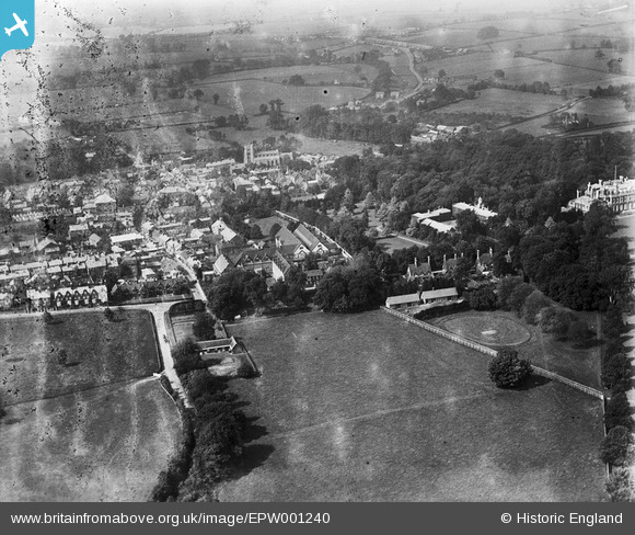
EPW001240 ENGLAND (1920). View of Tring, Tring, 1920
© Copyright OpenStreetMap contributors and licensed by the OpenStreetMap Foundation. 2026. Cartography is licensed as CC BY-SA.
Nearby Images (9)
EPW001240

EAW048773

EPW056442

EPW001246

EAW048775

EPW056445

EPW022477

EPW022476

EPW001243

Details
| Title | [EPW001240] View of Tring, Tring, 1920 |
| Reference | EPW001240 |
| Date | May-1920 |
| Link | |
| Place name | TRING |
| Parish | TRING |
| District | |
| Country | ENGLAND |
| Easting / Northing | 492477, 211133 |
| Longitude / Latitude | -0.65901656357338, 51.790748217596 |
| National Grid Reference | SP925111 |
Pins
Be the first to add a comment to this image!