
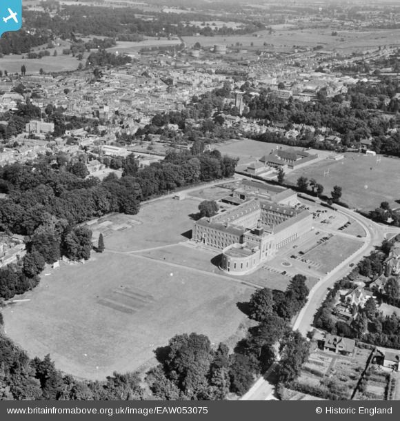
EAW053075 ENGLAND (1954). County Hall, Hertford, 1954
© Copyright OpenStreetMap contributors and licensed by the OpenStreetMap Foundation. 2026. Cartography is licensed as CC BY-SA.
Nearby Images (8)
EAW053075

EAW000040

EAW000039

EAW000041

EAW000042

EAW000043

EAW000044

EAW052996

Details
| Title | [EAW053075] County Hall, Hertford, 1954 |
| Reference | EAW053075 |
| Date | 4-January-1954 |
| Link | |
| Place name | HERTFORD |
| Parish | HERTFORD |
| District | |
| Country | ENGLAND |
| Easting / Northing | 532438, 212071 |
| Longitude / Latitude | -0.07949317005113, 51.791144222853 |
| National Grid Reference | TL324121 |
Pins

pscandrett |
Sunday 15th of April 2018 11:14:14 PM | |

Sparky |
Sunday 3rd of September 2017 05:16:20 PM |