
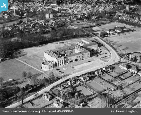
EAW000041 ENGLAND (1946). The County Hall, Hertford, 1946
© Copyright OpenStreetMap contributors and licensed by the OpenStreetMap Foundation. 2026. Cartography is licensed as CC BY-SA.
Nearby Images (8)
EAW000041

EAW000042

EAW000044

EAW000043

EAW000040

EAW000039

EAW052996

EAW053075

Details
| Title | [EAW000041] The County Hall, Hertford, 1946 |
| Reference | EAW000041 |
| Date | 25-March-1946 |
| Link | |
| Place name | HERTFORD |
| Parish | HERTFORD |
| District | |
| Country | ENGLAND |
| Easting / Northing | 532438, 211997 |
| Longitude / Latitude | -0.07952142602826, 51.790479184488 |
| National Grid Reference | TL324120 |
Pins

Matt Aldred edob.mattaldred.com |
Wednesday 17th of March 2021 04:08:55 PM | |

Nick G |
Sunday 20th of October 2013 07:46:55 PM | |
|
Nick G |
Sunday 20th of October 2013 07:46:10 PM | |
|
Nick G |
Sunday 20th of October 2013 07:45:33 PM | |
|
Nick G |
Sunday 20th of October 2013 07:44:23 PM | |
|
Nick G |
Sunday 20th of October 2013 07:44:04 PM | |
|
Nick G |
Sunday 20th of October 2013 07:43:05 PM |