
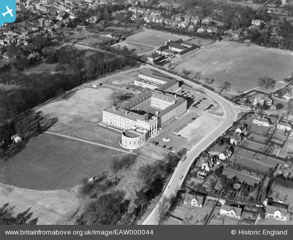
EAW000044 ENGLAND (1946). The County Hall, Hertford, 1946
© Copyright OpenStreetMap contributors and licensed by the OpenStreetMap Foundation. 2026. Cartography is licensed as CC BY-SA.
Nearby Images (8)
EAW000044

EAW000042

EAW000041

EAW000043

EAW000039

EAW000040

EAW052996

EAW053075

Details
| Title | [EAW000044] The County Hall, Hertford, 1946 |
| Reference | EAW000044 |
| Date | 25-March-1946 |
| Link | |
| Place name | HERTFORD |
| Parish | HERTFORD |
| District | |
| Country | ENGLAND |
| Easting / Northing | 532430, 211988 |
| Longitude / Latitude | -0.079640799691243, 51.790400195644 |
| National Grid Reference | TL324120 |
Pins
Be the first to add a comment to this image!