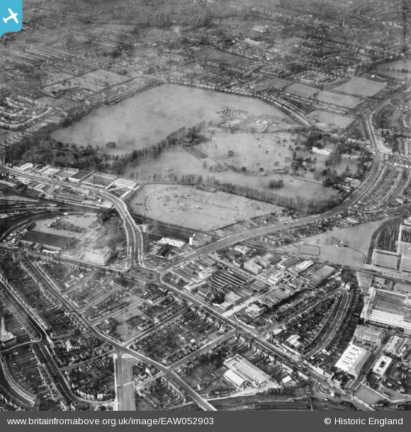
EAW052903 ENGLAND (1953). Kensington Cemetery, Gunnersbury Park and the surrounding area, Brentford, 1953
    © Copyright OpenStreetMap contributors and licensed by the OpenStreetMap Foundation. 2025. Cartography is licensed as CC BY-SA.
  
Nearby Images (21)
Details
| Title | [EAW052903] Kensington Cemetery, Gunnersbury Park and the surrounding area, Brentford, 1953 | 
| Reference | EAW052903 | 
| Date | 3-December-1953 | 
| Link | |
| Place name | BRENTFORD | 
| Parish | |
| District | |
| Country | ENGLAND | 
| Easting / Northing | 519162, 178687 | 
| Longitude / Latitude | -0.28328400000116, 51.494067770557 | 
| National Grid Reference | TQ192787 | 
Pins
|  Site of the admin/accommodation buildings associated with the 2ndWW HAA Gun Battery at Gunnersbury Park, designation ZW11/- (GDA London). |   redmist | Wednesday 24th of November 2021 10:21:27 PM | 
 
             
  ![[EAW052903] Kensington Cemetery, Gunnersbury Park and the surrounding area, Brentford, 1953](http://britainfromabove.org.uk/sites/all/libraries/aerofilms-images/public/100x100/EAW/052/EAW052903.jpg) 
  
                                          ![[EAW052935] Kensington Cemetery and the surrounding area, Brentford, 1953](http://britainfromabove.org.uk/sites/all/libraries/aerofilms-images/public/100x100/EAW/052/EAW052935.jpg) 
 ![[EAW052901] Brentford Fruit and Vegetable Market, Kensington Cemetery and the surrounding area, Brentford, 1953](http://britainfromabove.org.uk/sites/all/libraries/aerofilms-images/public/100x100/EAW/052/EAW052901.jpg) 
 ![[EAW052908] The Potomac, Kensington Cemetery and the surrounding area, Brentford, 1953](http://britainfromabove.org.uk/sites/all/libraries/aerofilms-images/public/100x100/EAW/052/EAW052908.jpg) 
 ![[EAW052936] Brentford Fruit and Vegetable Market, Kensington Cemetery and the surrounding area, Brentford, 1953](http://britainfromabove.org.uk/sites/all/libraries/aerofilms-images/public/100x100/EAW/052/EAW052936.jpg) 
 ![[EAW052940] Kensington Cemetery, Gunnersbury Park and the surrounding area, Brentford, 1953](http://britainfromabove.org.uk/sites/all/libraries/aerofilms-images/public/100x100/EAW/052/EAW052940.jpg) 
 ![[EAW052909] The Potomac, Kensington Cemetery and the surrounding area, Brentford, 1953](http://britainfromabove.org.uk/sites/all/libraries/aerofilms-images/public/100x100/EAW/052/EAW052909.jpg) 
 ![[EAW052898] The Potomac, Kensington Cemetery and the surrounding industrial area, Brentford, 1953](http://britainfromabove.org.uk/sites/all/libraries/aerofilms-images/public/100x100/EAW/052/EAW052898.jpg) 
 ![[EAW052902] Brentford Fruit and Vegetable Market, Kensington Cemetery and the surrounding area, Brentford, 1953](http://britainfromabove.org.uk/sites/all/libraries/aerofilms-images/public/100x100/EAW/052/EAW052902.jpg) 
 ![[EAW052937] Kensington Cemetery, Gunnersbury Park and the surrounding area, Brentford, 1953](http://britainfromabove.org.uk/sites/all/libraries/aerofilms-images/public/100x100/EAW/052/EAW052937.jpg) 
 ![[EAW052900] Brentford Fruit and Vegetable Market, Kensington Cemetery and the surrounding area, Brentford, 1953](http://britainfromabove.org.uk/sites/all/libraries/aerofilms-images/public/100x100/EAW/052/EAW052900.jpg) 
 ![[EAW052939] Power Road, Kensington Cemetery, Gunnersbury Park and the surrounding area, Brentford, 1953](http://britainfromabove.org.uk/sites/all/libraries/aerofilms-images/public/100x100/EAW/052/EAW052939.jpg) 
 ![[EAW052943] Brentford Fruit and Vegetable Market, Kensington Cemetery and the surrounding area, Brentford, 1953](http://britainfromabove.org.uk/sites/all/libraries/aerofilms-images/public/100x100/EAW/052/EAW052943.jpg) 
 ![[EAW052942] Brentford Fruit and Vegetable Market, Kensington Cemetery, Gunnersbury Park and the surrounding area, Brentford, 1953](http://britainfromabove.org.uk/sites/all/libraries/aerofilms-images/public/100x100/EAW/052/EAW052942.jpg) 
 ![[EAW052938] Kensington Cemetery, Gunnersbury Park and the surrounding area, Brentford, 1953](http://britainfromabove.org.uk/sites/all/libraries/aerofilms-images/public/100x100/EAW/052/EAW052938.jpg) 
 ![[EAW052910] Gunnersbury Park, Kensington Cemetery and the surrounding area, Brentford, 1953](http://britainfromabove.org.uk/sites/all/libraries/aerofilms-images/public/100x100/EAW/052/EAW052910.jpg) 
 ![[EAW052906] Power Road, Kensington Cemetery and the surrounding area, Brentford, 1953](http://britainfromabove.org.uk/sites/all/libraries/aerofilms-images/public/100x100/EAW/052/EAW052906.jpg) 
 ![[EAW052899] The Great West Road, Kensington Cemetery and the surrounding industrial area, Brentford, 1953](http://britainfromabove.org.uk/sites/all/libraries/aerofilms-images/public/100x100/EAW/052/EAW052899.jpg) 
 ![[EAW052905] Kensington Cemetery, Gunnersbury Park and the surrounding area, Brentford, 1953](http://britainfromabove.org.uk/sites/all/libraries/aerofilms-images/public/100x100/EAW/052/EAW052905.jpg) 
 ![[EAW052941] Gunnersbury Park, Kensington Cemetery and the surrounding area, Brentford, 1953](http://britainfromabove.org.uk/sites/all/libraries/aerofilms-images/public/100x100/EAW/052/EAW052941.jpg) 
 ![[EPR000528] The Diamond Switches Factory and Permutit House (United Water Softeners Ltd) on Gunnersbury Avenue, Gunnersbury, 1935](http://britainfromabove.org.uk/sites/all/libraries/aerofilms-images/public/100x100/EPR/000/EPR000528.jpg)