
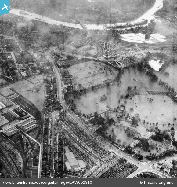
EAW052910 ENGLAND (1953). Gunnersbury Park, Kensington Cemetery and the surrounding area, Brentford, 1953
© Copyright OpenStreetMap contributors and licensed by the OpenStreetMap Foundation. 2026. Cartography is licensed as CC BY-SA.
Nearby Images (15)
EAW052910

EAW052902

EAW052938

EAW052903

EAW052936

EAW052935

EAW052941

EAW052937

EAW052908

EAW052901

EAW052940

EAW052898

EAW052909

EAW052942

EAW052939

Details
| Title | [EAW052910] Gunnersbury Park, Kensington Cemetery and the surrounding area, Brentford, 1953 |
| Reference | EAW052910 |
| Date | 3-November-1953 |
| Link | |
| Place name | BRENTFORD |
| Parish | |
| District | |
| Country | ENGLAND |
| Easting / Northing | 519201, 178849 |
| Longitude / Latitude | -0.28266768310915, 51.495515679912 |
| National Grid Reference | TQ192788 |
