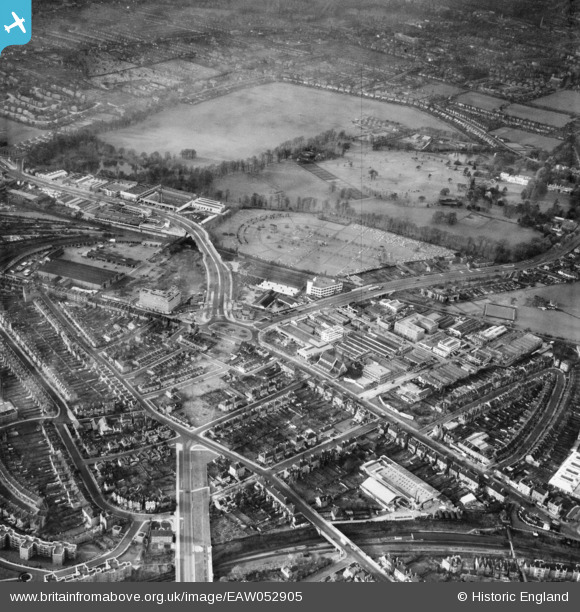
EAW052905 ENGLAND (1953). Kensington Cemetery, Gunnersbury Park and the surrounding area, Brentford, 1953
    © Copyright OpenStreetMap contributors and licensed by the OpenStreetMap Foundation. 2025. Cartography is licensed as CC BY-SA.
  
Nearby Images (17)
Details
| Title | [EAW052905] Kensington Cemetery, Gunnersbury Park and the surrounding area, Brentford, 1953 | 
| Reference | EAW052905 | 
| Date | 3-December-1953 | 
| Link | |
| Place name | BRENTFORD | 
| Parish | |
| District | |
| Country | ENGLAND | 
| Easting / Northing | 519291, 178507 | 
| Longitude / Latitude | -0.28148730452431, 51.492422636409 | 
| National Grid Reference | TQ193785 | 
Pins
|  Site of the admin/accommodation buildings associated with the 2ndWW HAA Gun Battery at Gunnersbury Park, designation ZW11/- (GDA London). |   redmist | Wednesday 24th of November 2021 10:20:55 PM | 
|  Chiswick Village |   Des Elmes | Thursday 14th of April 2016 02:59:09 PM | 
|  Prefabs on Lionel Road (North) |   Des Elmes | Thursday 14th of April 2016 02:56:10 PM | 
|  Clearing the area for the Great West Road extension. Further demolition occurred later in the '50s when the flyover was added. |   Des Elmes | Thursday 14th of April 2016 02:53:43 PM | 
|  Gunnersbury Station.
Photograph is from 1955, with District Line Q-Stock train. |   Leslie B | Saturday 5th of March 2016 07:46:38 AM | 
|  The John Bull Pub |   Leslie B | Friday 4th of March 2016 11:36:39 PM | 
|  Original Ticket Office for Gunnersbury Station. |   Leslie B | Friday 4th of March 2016 11:35:51 PM | 
 
             
  ![[EAW052905] Kensington Cemetery, Gunnersbury Park and the surrounding area, Brentford, 1953](http://britainfromabove.org.uk/sites/all/libraries/aerofilms-images/public/100x100/EAW/052/EAW052905.jpg) 
  
                                          ![[EAW052906] Power Road, Kensington Cemetery and the surrounding area, Brentford, 1953](http://britainfromabove.org.uk/sites/all/libraries/aerofilms-images/public/100x100/EAW/052/EAW052906.jpg) 
 ![[EPR000528] The Diamond Switches Factory and Permutit House (United Water Softeners Ltd) on Gunnersbury Avenue, Gunnersbury, 1935](http://britainfromabove.org.uk/sites/all/libraries/aerofilms-images/public/100x100/EPR/000/EPR000528.jpg) 
 ![[EAW052900] Brentford Fruit and Vegetable Market, Kensington Cemetery and the surrounding area, Brentford, 1953](http://britainfromabove.org.uk/sites/all/libraries/aerofilms-images/public/100x100/EAW/052/EAW052900.jpg) 
 ![[EAW052908] The Potomac, Kensington Cemetery and the surrounding area, Brentford, 1953](http://britainfromabove.org.uk/sites/all/libraries/aerofilms-images/public/100x100/EAW/052/EAW052908.jpg) 
 ![[EAW052901] Brentford Fruit and Vegetable Market, Kensington Cemetery and the surrounding area, Brentford, 1953](http://britainfromabove.org.uk/sites/all/libraries/aerofilms-images/public/100x100/EAW/052/EAW052901.jpg) 
 ![[EAW052943] Brentford Fruit and Vegetable Market, Kensington Cemetery and the surrounding area, Brentford, 1953](http://britainfromabove.org.uk/sites/all/libraries/aerofilms-images/public/100x100/EAW/052/EAW052943.jpg) 
 ![[EAW052935] Kensington Cemetery and the surrounding area, Brentford, 1953](http://britainfromabove.org.uk/sites/all/libraries/aerofilms-images/public/100x100/EAW/052/EAW052935.jpg) 
 ![[EAW052903] Kensington Cemetery, Gunnersbury Park and the surrounding area, Brentford, 1953](http://britainfromabove.org.uk/sites/all/libraries/aerofilms-images/public/100x100/EAW/052/EAW052903.jpg) 
 ![[EAW052904] Brentford Fruit and Vegetable Market, Kensington Cemetery and the surrounding area, Brentford, 1953](http://britainfromabove.org.uk/sites/all/libraries/aerofilms-images/public/100x100/EAW/052/EAW052904.jpg) 
 ![[EAW052940] Kensington Cemetery, Gunnersbury Park and the surrounding area, Brentford, 1953](http://britainfromabove.org.uk/sites/all/libraries/aerofilms-images/public/100x100/EAW/052/EAW052940.jpg) 
 ![[EAW052909] The Potomac, Kensington Cemetery and the surrounding area, Brentford, 1953](http://britainfromabove.org.uk/sites/all/libraries/aerofilms-images/public/100x100/EAW/052/EAW052909.jpg) 
 ![[EAW052907] Kensington Cemetery, Gunnersbury Park and the surrounding area, Brentford, from the south-east, 1953](http://britainfromabove.org.uk/sites/all/libraries/aerofilms-images/public/100x100/EAW/052/EAW052907.jpg) 
 ![[EAW052899] The Great West Road, Kensington Cemetery and the surrounding industrial area, Brentford, 1953](http://britainfromabove.org.uk/sites/all/libraries/aerofilms-images/public/100x100/EAW/052/EAW052899.jpg) 
 ![[EAW052898] The Potomac, Kensington Cemetery and the surrounding industrial area, Brentford, 1953](http://britainfromabove.org.uk/sites/all/libraries/aerofilms-images/public/100x100/EAW/052/EAW052898.jpg) 
 ![[EAW052936] Brentford Fruit and Vegetable Market, Kensington Cemetery and the surrounding area, Brentford, 1953](http://britainfromabove.org.uk/sites/all/libraries/aerofilms-images/public/100x100/EAW/052/EAW052936.jpg) 
 ![[EAW052937] Kensington Cemetery, Gunnersbury Park and the surrounding area, Brentford, 1953](http://britainfromabove.org.uk/sites/all/libraries/aerofilms-images/public/100x100/EAW/052/EAW052937.jpg) 
 