
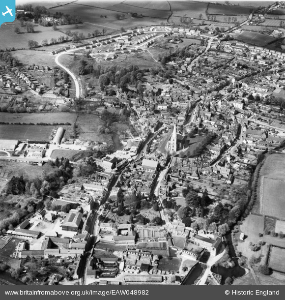
EAW048982 ENGLAND (1953). The town, Buckingham, 1953
© Copyright OpenStreetMap contributors and licensed by the OpenStreetMap Foundation. 2026. Cartography is licensed as CC BY-SA.
Nearby Images (11)
EAW048982

EPW005040

EPW005042

EAW015424

EAW015426

EAW048981

EAW015425

EPW005041

EPW005043

EAW015427

EAW048983

Details
| Title | [EAW048982] The town, Buckingham, 1953 |
| Reference | EAW048982 |
| Date | 5-May-1953 |
| Link | |
| Place name | BUCKINGHAM |
| Parish | BUCKINGHAM |
| District | |
| Country | ENGLAND |
| Easting / Northing | 469418, 233795 |
| Longitude / Latitude | -0.98875994203405, 51.997828755763 |
| National Grid Reference | SP694338 |
Pins

MB |
Thursday 22nd of September 2016 06:42:27 PM | |
|
MB |
Thursday 22nd of September 2016 06:41:59 PM | |
|
alastair wallace |
Saturday 31st of October 2015 11:03:34 PM |