
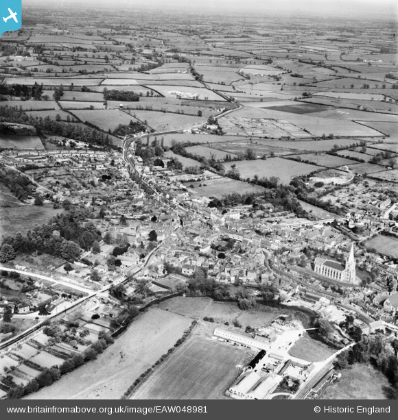
EAW048981 ENGLAND (1953). The town, Buckingham, from the west, 1953
© Copyright OpenStreetMap contributors and licensed by the OpenStreetMap Foundation. 2026. Cartography is licensed as CC BY-SA.
Nearby Images (10)
EAW048981

EAW048982

EAW015425

EAW015424

EPW005040

EPW005042

EAW015426

EAW048980

EAW048983

EAW015428

Details
| Title | [EAW048981] The town, Buckingham, from the west, 1953 |
| Reference | EAW048981 |
| Date | 5-May-1953 |
| Link | |
| Place name | BUCKINGHAM |
| Parish | BUCKINGHAM |
| District | |
| Country | ENGLAND |
| Easting / Northing | 469377, 233882 |
| Longitude / Latitude | -0.98933949030278, 51.998616041006 |
| National Grid Reference | SP694339 |
Pins

MB |
Thursday 22nd of September 2016 06:48:05 PM | |
|
MB |
Thursday 22nd of September 2016 06:46:55 PM | |
|
MB |
Thursday 22nd of September 2016 06:46:09 PM | |
|
alastair wallace |
Saturday 31st of October 2015 11:01:56 PM |