
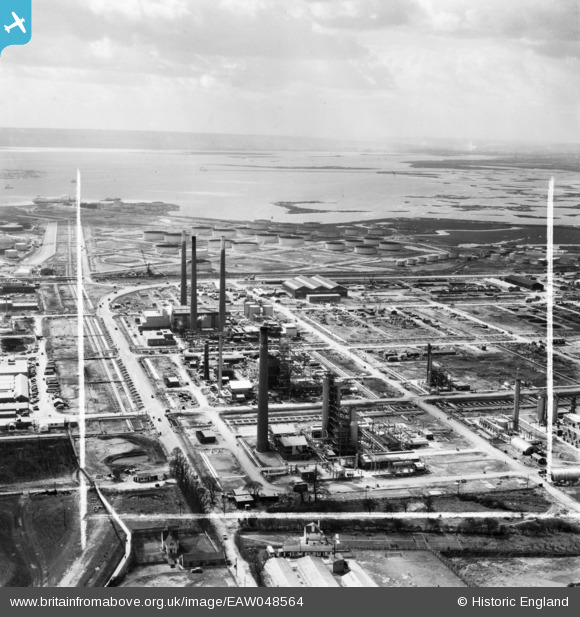
EAW048564 ENGLAND (1953). The Anglo-Iranian Oil Co Ltd Kent Oil Refinery under construction, Isle of Grain, from the north-east, 1953. This image was marked by Aerofilms Ltd for photo editing.
© Copyright OpenStreetMap contributors and licensed by the OpenStreetMap Foundation. 2026. Cartography is licensed as CC BY-SA.
Nearby Images (20)
EAW048564

EAW045778

EAW045777

EAW048565

EAW048527

EAW045779

EAW045752

EAW045764

EAW045768

EAW045781

EAW045783

EAW048513

EAW039859

EAW045782

EAW048525

EAW048566

EAW048526

EAW039857

EAW048562

EAW048561

Details
| Title | [EAW048564] The Anglo-Iranian Oil Co Ltd Kent Oil Refinery under construction, Isle of Grain, from the north-east, 1953. This image was marked by Aerofilms Ltd for photo editing. |
| Reference | EAW048564 |
| Date | 31-March-1953 |
| Link | |
| Place name | ISLE OF GRAIN |
| Parish | ISLE OF GRAIN |
| District | |
| Country | ENGLAND |
| Easting / Northing | 587193, 175424 |
| Longitude / Latitude | 0.69412714136654, 51.44632919623 |
| National Grid Reference | TQ872754 |
Pins
Be the first to add a comment to this image!