
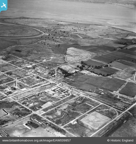
EAW039857 ENGLAND (1951). The Anglo-Iranian Oil Co oil refinery under construction, Isle of Grain, 1951. This image has been produced from a damaged negative.
© Copyright OpenStreetMap contributors and licensed by the OpenStreetMap Foundation. 2026. Cartography is licensed as CC BY-SA.
Nearby Images (12)
EAW039857

EAW048526

EAW045779

EAW048565

EAW045782

EAW045781

EAW039856

EAW045783

EAW045777

EAW045778

EAW034854

EAW048564

Details
| Title | [EAW039857] The Anglo-Iranian Oil Co oil refinery under construction, Isle of Grain, 1951. This image has been produced from a damaged negative. |
| Reference | EAW039857 |
| Date | 20-August-1951 |
| Link | |
| Place name | ISLE OF GRAIN |
| Parish | ISLE OF GRAIN |
| District | |
| Country | ENGLAND |
| Easting / Northing | 587332, 175653 |
| Longitude / Latitude | 0.69624651922304, 51.44834025307 |
| National Grid Reference | TQ873757 |
Pins

redmist |
Monday 24th of January 2022 10:49:50 PM | |
|
redmist |
Monday 24th of January 2022 10:46:52 PM | |
|
redmist |
Monday 24th of January 2022 10:41:38 PM | |
|
redmist |
Monday 24th of January 2022 10:39:59 PM | |
|
redmist |
Monday 24th of January 2022 10:38:45 PM |