
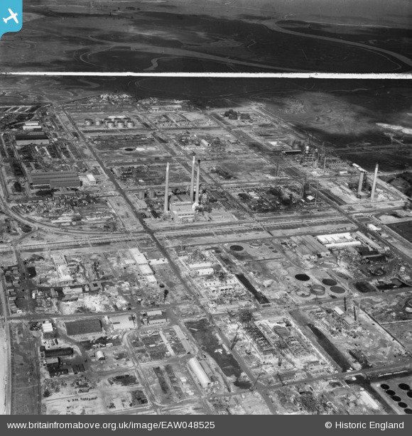
EAW048525 ENGLAND (1953). The Anglo-Iranian Oil Co Ltd Kent Oil Refinery under construction, Isle of Grain, 1953. This image was marked by Aerofilms Ltd for photo editing.
© Copyright OpenStreetMap contributors and licensed by the OpenStreetMap Foundation. 2026. Cartography is licensed as CC BY-SA.
Nearby Images (22)
EAW048525

EAW048562

EAW048566

EAW048561

EAW045780

EAW045764

EAW045768

EAW048563

EAW048518

EAW048513

EAW048522

EAW045771

EAW048516

EAW034851

EAW034852

EAW048527

EAW048564

EAW048519

EAW048514

EAW045763

EAW045770

EAW045753

Details
| Title | [EAW048525] The Anglo-Iranian Oil Co Ltd Kent Oil Refinery under construction, Isle of Grain, 1953. This image was marked by Aerofilms Ltd for photo editing. |
| Reference | EAW048525 |
| Date | 27-March-1953 |
| Link | |
| Place name | ISLE OF GRAIN |
| Parish | ISLE OF GRAIN |
| District | |
| Country | ENGLAND |
| Easting / Northing | 587062, 175218 |
| Longitude / Latitude | 0.69213510497069, 51.44452205651 |
| National Grid Reference | TQ871752 |
Pins
Be the first to add a comment to this image!