
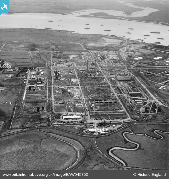
EAW045753 ENGLAND (1952). The Anglo-Iranian Oil Co Ltd Kent Oil Refinery under construction, Isle of Grain, 1952
© Copyright OpenStreetMap contributors and licensed by the OpenStreetMap Foundation. 2026. Cartography is licensed as CC BY-SA.
Nearby Images (22)
EAW045753

EAW045772

EAW045766

EAW045767

EAW034855

EAW048528

EAW048516

EAW048522

EAW045765

EAW034856

EAW045752

EAW048524

EAW045751

EAW039854

EAW048530

EAW045760

EAW045768

EAW045764

EAW048561

EAW048562

EAW048525

EAW048566

Details
| Title | [EAW045753] The Anglo-Iranian Oil Co Ltd Kent Oil Refinery under construction, Isle of Grain, 1952 |
| Reference | EAW045753 |
| Date | 12-August-1952 |
| Link | |
| Place name | ISLE OF GRAIN |
| Parish | ISLE OF GRAIN |
| District | |
| Country | ENGLAND |
| Easting / Northing | 586846, 175432 |
| Longitude / Latitude | 0.68914317526385, 51.446515653523 |
| National Grid Reference | TQ868754 |
Pins

redmist |
Monday 24th of January 2022 11:15:06 PM | |
|
redmist |
Monday 24th of January 2022 11:13:23 PM | |
|
redmist |
Saturday 22nd of January 2022 09:29:22 PM | |
|
redmist |
Saturday 22nd of January 2022 09:28:58 PM | |
|
redmist |
Saturday 22nd of January 2022 09:28:39 PM | |
|
redmist |
Saturday 22nd of January 2022 09:28:23 PM | |
|
redmist |
Saturday 22nd of January 2022 09:28:06 PM | |
|
redmist |
Saturday 22nd of January 2022 09:27:48 PM | |
|
Kentishman |
Friday 19th of August 2016 09:34:53 AM | |
|
Kentishman |
Friday 19th of August 2016 09:34:03 AM | |
|
Kentishman |
Friday 19th of August 2016 09:27:40 AM | |
|
Kentishman |
Friday 19th of August 2016 09:26:58 AM | |
|
Kentishman |
Friday 19th of August 2016 09:24:57 AM | |
|
Kentishman |
Friday 19th of August 2016 09:08:53 AM |