
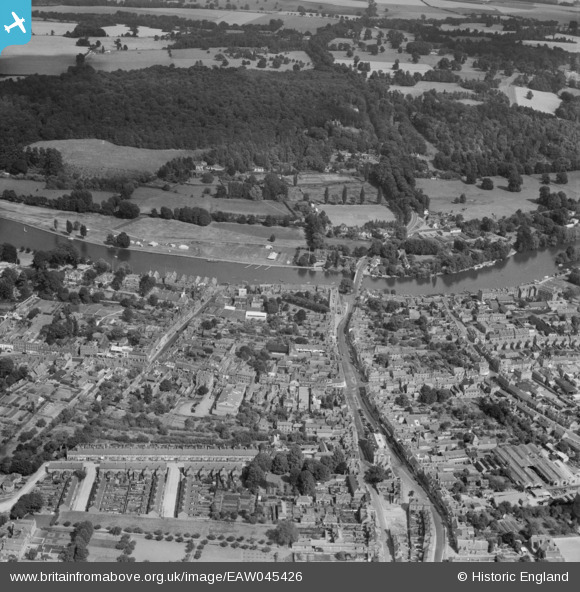
EAW045426 ENGLAND (1952). The town and Remenham Wood, Henley-on-Thames, 1952
© Copyright OpenStreetMap contributors and licensed by the OpenStreetMap Foundation. 2026. Cartography is licensed as CC BY-SA.
Nearby Images (24)
EAW045426

EPW035809

EAW044517

EAW045422

EPW000855

EAW044544

EPW022749

EAW024273

EAW024274

EAW045424

EAW044543

EAW044518

EAW044545

EAW045423

EPW008861

EAW024272

EAW045425

EPW008856

EPW000853

EPW008860

EAW044537

EPW008853

EAW044541

EAW044549

Details
| Title | [EAW045426] The town and Remenham Wood, Henley-on-Thames, 1952 |
| Reference | EAW045426 |
| Date | 6-August-1952 |
| Link | |
| Place name | HENLEY-ON-THAMES |
| Parish | HENLEY-ON-THAMES |
| District | |
| Country | ENGLAND |
| Easting / Northing | 476346, 182729 |
| Longitude / Latitude | -0.89908330109455, 51.537814515583 |
| National Grid Reference | SU763827 |
Pins
Be the first to add a comment to this image!