
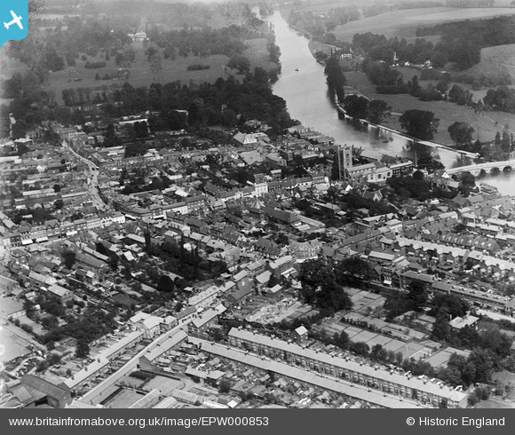
EPW000853 ENGLAND (1920). Hart Street area, Henley-on-Thames, 1920
© Copyright OpenStreetMap contributors and licensed by the OpenStreetMap Foundation. 2026. Cartography is licensed as CC BY-SA.
Nearby Images (13)
EPW000853

EAW045425

EPW022749

EAW044518

EAW045422

EPW022748

EAW045424

EPW000855

EAW045426

EPW035809

EPW022747

EAW044544

EAW044543

Details
| Title | [EPW000853] Hart Street area, Henley-on-Thames, 1920 |
| Reference | EPW000853 |
| Date | May-1920 |
| Link | |
| Place name | HENLEY-ON-THAMES |
| Parish | HENLEY-ON-THAMES |
| District | |
| Country | ENGLAND |
| Easting / Northing | 476154, 182610 |
| Longitude / Latitude | -0.9018771619357, 51.536770553215 |
| National Grid Reference | SU762826 |
