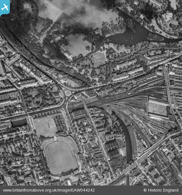
EAW044242 ENGLAND (1952). Lord's Cricket Ground, Regent's Park Boating Lake and the surrounding area, St John's Wood, 1952
© Copyright OpenStreetMap contributors and licensed by the OpenStreetMap Foundation. 2026. Cartography is licensed as CC BY-SA.
Nearby Images (9)
EAW044242

EPW027018

EPW009008

EPW039580

EAW044240

EPW027025

EPW009006

EPW009007

EPW005641

Details
| Title | [EAW044242] Lord's Cricket Ground, Regent's Park Boating Lake and the surrounding area, St John's Wood, 1952 |
| Reference | EAW044242 |
| Date | 23-June-1952 |
| Link | |
| Place name | ST JOHN'S WOOD |
| Parish | |
| District | |
| Country | ENGLAND |
| Easting / Northing | 527238, 182720 |
| Longitude / Latitude | -0.16554281142034, 51.528555732531 |
| National Grid Reference | TQ272827 |
Pins

Kathy Emery |
Sunday 8th of August 2021 12:14:15 PM | |
|
Kathy Emery |
Sunday 8th of August 2021 12:13:07 PM | |
|
Kathy Emery |
Sunday 8th of August 2021 12:10:45 PM | |
|
Robin |
Tuesday 18th of August 2020 08:23:51 PM | |
|
FramptonStreetBoy |
Wednesday 2nd of October 2019 09:46:15 PM | |
|
FramptonStreetBoy |
Wednesday 2nd of October 2019 09:43:46 PM | |
|
John W |
Tuesday 15th of November 2016 05:25:14 PM | |
|
John W |
Tuesday 15th of November 2016 04:40:21 PM | |
|
John W |
Tuesday 15th of November 2016 04:35:50 PM | |
|
John W |
Tuesday 15th of November 2016 04:34:51 PM | |
|
John W |
Tuesday 15th of November 2016 04:26:29 PM | |
|
John W |
Tuesday 15th of November 2016 04:25:05 PM | |
|
John W |
Tuesday 15th of November 2016 04:24:09 PM | |
|
John W |
Tuesday 15th of November 2016 04:20:49 PM | |
|
John W |
Tuesday 15th of November 2016 04:05:12 PM | |

Class31 |
Wednesday 8th of October 2014 03:24:01 PM | |
|
Class31 |
Wednesday 8th of October 2014 03:23:21 PM | |
|
Class31 |
Wednesday 8th of October 2014 03:21:17 PM | |
|
Class31 |
Wednesday 8th of October 2014 03:19:59 PM | |
|
Class31 |
Wednesday 8th of October 2014 03:18:39 PM | |
|
Class31 |
Wednesday 8th of October 2014 02:50:18 PM | |
|
Class31 |
Wednesday 8th of October 2014 02:49:29 PM |