
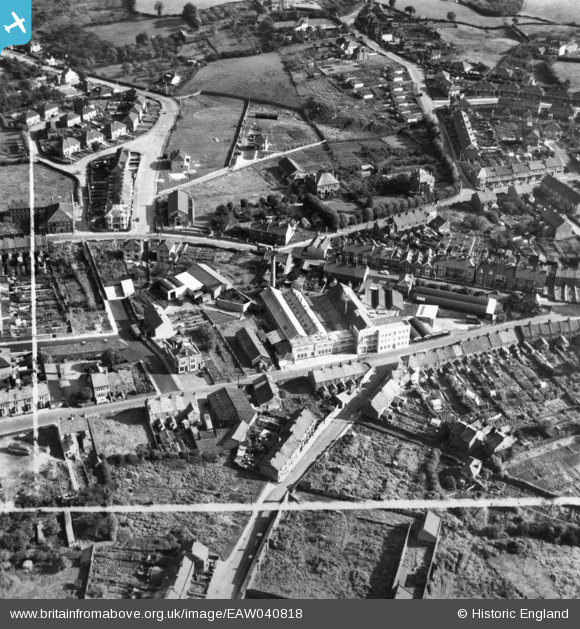
EAW040818 ENGLAND (1951). T. Lucas and Co Ltd Ruskit Flour Mills and environs, Kingswood, 1951. This image has been produced from a print marked by Aerofilms Ltd for photo editing.
© Copyright OpenStreetMap contributors and licensed by the OpenStreetMap Foundation. 2026. Cartography is licensed as CC BY-SA.
Nearby Images (16)
EAW040818

EAW040817

EAW040811

EAW040812

EAW040810

EAW040813

EAW040815

EAW040814

EAW040816

EPW016943

EPW016944

EAW002033
 Ltd Motorcycle Factory and Sports Ground, Kingswood, 1946")
EAW002040
 Ltd Motorcycle Factory and Sports Ground, Kingswood, 1946")
EAW002036
 Ltd Motorcycle Factory and Sports Ground and the town, Kingswood, 1946")
EPW016947

EPW016948

Details
| Title | [EAW040818] T. Lucas and Co Ltd Ruskit Flour Mills and environs, Kingswood, 1951. This image has been produced from a print marked by Aerofilms Ltd for photo editing. |
| Reference | EAW040818 |
| Date | 13-October-1951 |
| Link | |
| Place name | KINGSWOOD |
| Parish | |
| District | |
| Country | ENGLAND |
| Easting / Northing | 364890, 173459 |
| Longitude / Latitude | -2.5054063833514, 51.458529707886 |
| National Grid Reference | ST649735 |


