
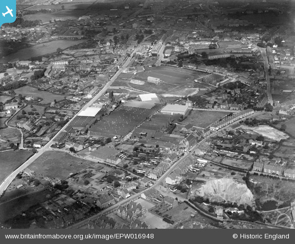
EPW016948 ENGLAND (1926). The Douglas Motorcycle Works and environs, Kingswood, 1926
© Copyright OpenStreetMap contributors and licensed by the OpenStreetMap Foundation. 2026. Cartography is licensed as CC BY-SA.
Nearby Images (24)
EPW016948

EAW002043
 Ltd Engineering Works, Kingswood, 1946")
EAW002042
 Ltd Motorcycle Factory and Sports Ground and the town, Kingswood, 1946")
EPW016942

EAW002034
 Ltd Motorcycle Factory, Kingswood, 1946")
EAW002041
 Ltd Motorcycle Factory and Sports Ground and the town, Kingswood, 1946")
EPW016946

EPW016945

EAW002037
 Ltd Motorcycle Factory and environs, Kingswood, 1946")
EAW002038
 Ltd Motorcycle Factory and environs, Kingswood, 1946")
EPW016947

EPW016944

EAW002035
 Ltd Motorcycle Factory and environs, Kingswood, 1946")
EAW002033
 Ltd Motorcycle Factory and Sports Ground, Kingswood, 1946")
EAW002036
 Ltd Motorcycle Factory and Sports Ground and the town, Kingswood, 1946")
EAW002040
 Ltd Motorcycle Factory and Sports Ground, Kingswood, 1946")
EAW002039
 Ltd Motorcycle Factory and environs, Kingswood, 1946")
EPW016943

EAW040814

EAW040815

EAW040810

EAW040812

EAW040818

EAW040817

Details
| Title | [EPW016948] The Douglas Motorcycle Works and environs, Kingswood, 1926 |
| Reference | EPW016948 |
| Date | 13-September-1926 |
| Link | |
| Place name | KINGSWOOD |
| Parish | |
| District | |
| Country | ENGLAND |
| Easting / Northing | 364649, 173264 |
| Longitude / Latitude | -2.5088559191789, 51.456761221947 |
| National Grid Reference | ST646733 |
Pins

redmist |
Monday 5th of December 2022 05:12:04 PM | |

Class31 |
Saturday 2nd of April 2016 11:14:41 PM | |
|
Class31 |
Sunday 11th of August 2013 11:03:30 PM | |
|
Peter Robbins |
Sunday 5th of May 2013 08:31:49 AM | |
|
Peter Robbins |
Sunday 5th of May 2013 08:25:01 AM | |
|
Class31 |
Wednesday 11th of July 2012 08:58:02 PM | |
|
Class31 |
Wednesday 11th of July 2012 08:56:55 PM | |
|
Peter Robbins |
Saturday 7th of July 2012 11:08:49 PM | |
|
Peter Robbins |
Saturday 7th of July 2012 11:07:21 PM | |
|
Peter Robbins |
Saturday 7th of July 2012 10:58:57 PM | |
|
Peter Robbins |
Saturday 7th of July 2012 10:57:54 PM | |
|
Peter Robbins |
Saturday 7th of July 2012 10:56:10 PM | |
|
Peter Robbins |
Saturday 7th of July 2012 10:54:48 PM | |
|
Peter Robbins |
Saturday 7th of July 2012 10:52:32 PM | |
|
Peter Robbins |
Saturday 7th of July 2012 10:49:58 PM | |
|
Peter Robbins |
Saturday 7th of July 2012 10:44:38 PM | |
|
Peter Robbins |
Saturday 7th of July 2012 10:39:43 PM | |
|
Peter Robbins |
Saturday 7th of July 2012 10:37:37 PM | |
|
Peter Robbins |
Saturday 7th of July 2012 10:32:55 PM | |
|
Peter Robbins |
Saturday 7th of July 2012 10:26:55 PM | |
|
Class31 |
Thursday 5th of July 2012 12:55:56 PM |

