
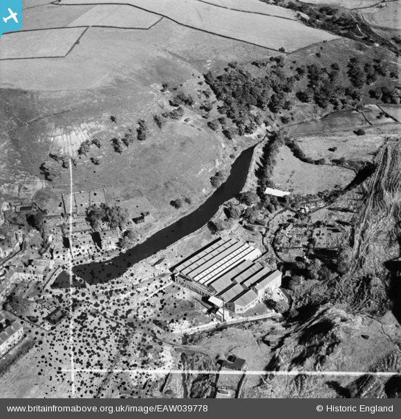
EAW039778 ENGLAND (1951). Ealees Mill, Littleborough, 1951. This image has been produced from a damaged negative.
© Copyright OpenStreetMap contributors and licensed by the OpenStreetMap Foundation. 2026. Cartography is licensed as CC BY-SA.
Nearby Images (8)
EAW039778

EAW039774

EAW039775

EAW039772

EAW039776

EAW039779

EAW039773

EAW039777

Details
| Title | [EAW039778] Ealees Mill, Littleborough, 1951. This image has been produced from a damaged negative. |
| Reference | EAW039778 |
| Date | 15-September-1951 |
| Link | |
| Place name | LITTLEBOROUGH |
| Parish | |
| District | |
| Country | ENGLAND |
| Easting / Northing | 394293, 416240 |
| Longitude / Latitude | -2.086334120987, 53.642408003927 |
| National Grid Reference | SD943162 |
Pins

wadey |
Thursday 4th of December 2014 04:23:51 PM |