
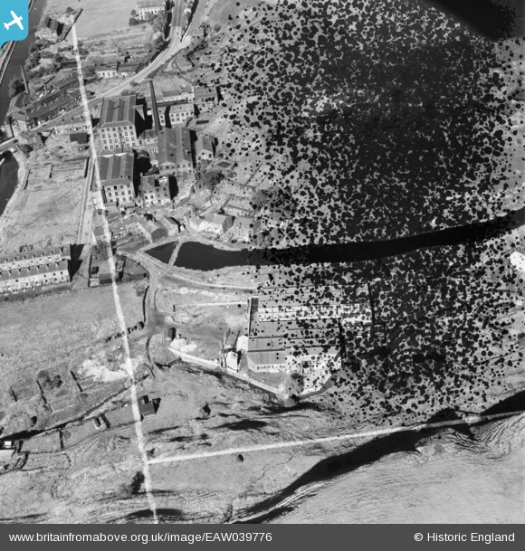
EAW039776 ENGLAND (1951). Ealees Mill and Durn Mill, Littleborough, 1951. This image has been produced from a damaged negative.
© Copyright OpenStreetMap contributors and licensed by the OpenStreetMap Foundation. 2026. Cartography is licensed as CC BY-SA.
Nearby Images (8)
EAW039776

EAW039772

EAW039778

EAW039774

EAW039775

EAW039779

EAW039773

EAW039777

Details
| Title | [EAW039776] Ealees Mill and Durn Mill, Littleborough, 1951. This image has been produced from a damaged negative. |
| Reference | EAW039776 |
| Date | 15-September-1951 |
| Link | |
| Place name | LITTLEBOROUGH |
| Parish | |
| District | |
| Country | ENGLAND |
| Easting / Northing | 394219, 416266 |
| Longitude / Latitude | -2.087454057216, 53.642640911624 |
| National Grid Reference | SD942163 |
Pins

wadey |
Thursday 4th of December 2014 04:22:24 PM | |
|
wadey |
Thursday 4th of December 2014 04:21:52 PM | |
|
wadey |
Thursday 4th of December 2014 04:20:36 PM | |
|
wadey |
Thursday 4th of December 2014 04:20:11 PM | |
|
wadey |
Thursday 4th of December 2014 04:19:11 PM | |
|
wadey |
Thursday 4th of December 2014 04:18:33 PM | |
|
wadey |
Thursday 4th of December 2014 04:18:08 PM |