
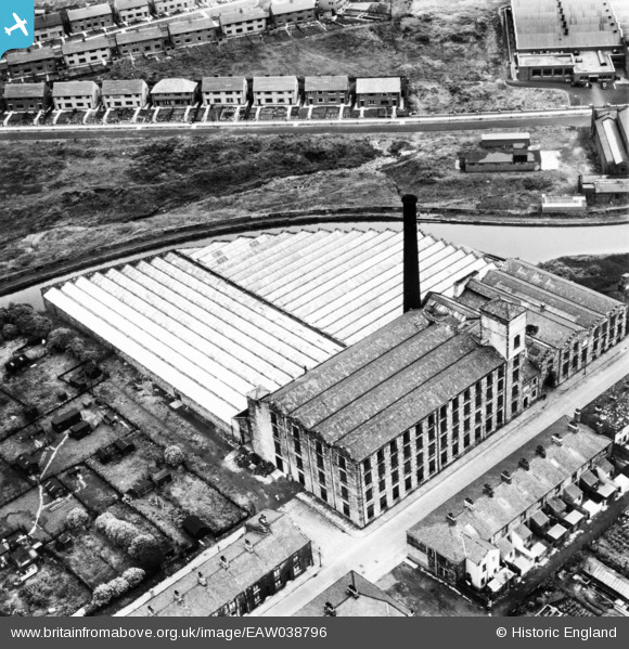
EAW038796 ENGLAND (1951). Rose Grove Mill, Rose Grove, 1951. This image has been produced from a print.
© Copyright OpenStreetMap contributors and licensed by the OpenStreetMap Foundation. 2026. Cartography is licensed as CC BY-SA.
Nearby Images (11)
EAW038796

EAW038802

EAW038795

EAW038797

EAW038799

EAW038800

EAW038801

EAW038798

EAW039610

EAW039611

EAW039609

Details
| Title | [EAW038796] Rose Grove Mill, Rose Grove, 1951. This image has been produced from a print. |
| Reference | EAW038796 |
| Date | 15-August-1951 |
| Link | |
| Place name | ROSE GROVE |
| Parish | |
| District | |
| Country | ENGLAND |
| Easting / Northing | 381944, 432666 |
| Longitude / Latitude | -2.2741035318588, 53.789781426461 |
| National Grid Reference | SD819327 |
Pins
Be the first to add a comment to this image!