
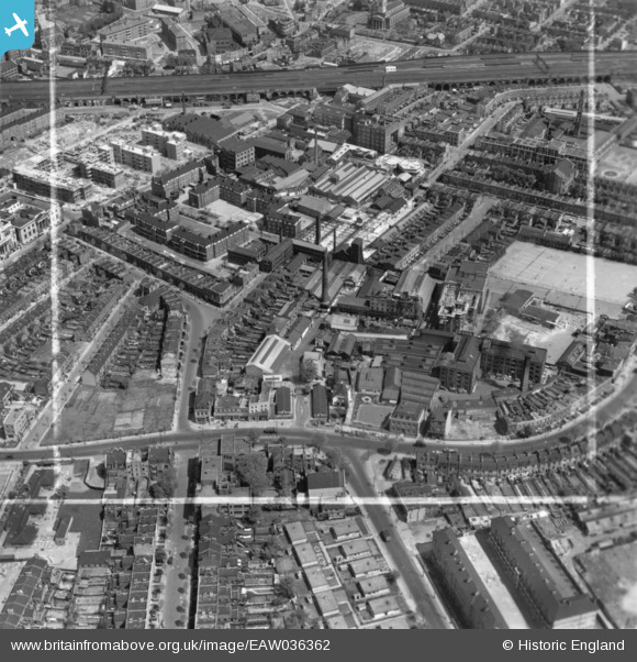
EAW036362 ENGLAND (1951). Southwark Park Road, the Eonia Soap Works and environs, Bermondsey, 1951. This image has been produced from a print marked by Aerofilms Ltd for photo editing.
© Copyright OpenStreetMap contributors and licensed by the OpenStreetMap Foundation. 2026. Cartography is licensed as CC BY-SA.
Nearby Images (18)
EAW036362

EAW036361

EAW036365

EAW036358

EAW036366

EAW036368

EAW036363

EAW036364

EAW036360

EAW036359

EAW036367

EAW041825

EPW055345

EAW041822

EAW041816

EAW041826

EPW060775

EAW041821

Details
| Title | [EAW036362] Southwark Park Road, the Eonia Soap Works and environs, Bermondsey, 1951. This image has been produced from a print marked by Aerofilms Ltd for photo editing. |
| Reference | EAW036362 |
| Date | 25-May-1951 |
| Link | |
| Place name | BERMONDSEY |
| Parish | |
| District | |
| Country | ENGLAND |
| Easting / Northing | 533886, 178993 |
| Longitude / Latitude | -0.071167682729588, 51.493522356905 |
| National Grid Reference | TQ339790 |
Pins
Be the first to add a comment to this image!