
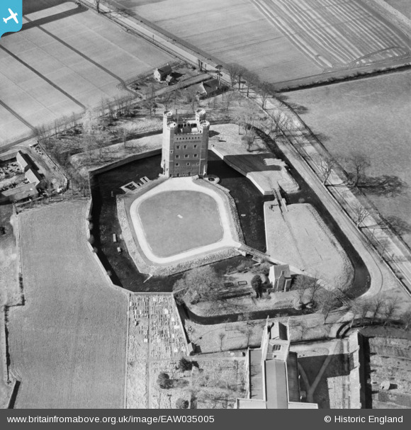
EAW035005 ENGLAND (1951). Tattershall Castle, Tattershall, 1951
© Copyright OpenStreetMap contributors and licensed by the OpenStreetMap Foundation. 2026. Cartography is licensed as CC BY-SA.
Nearby Images (16)
EAW035005

EAW035007

EAW035006

EAW035010

EAW035011

EAW005051

EAW005050

EAW035009

EAW005049

EAW005052

EAW035008

EAW005053

EAW005047

EAW005048

EAW013971

EAW013972

Details
| Title | [EAW035005] Tattershall Castle, Tattershall, 1951 |
| Reference | EAW035005 |
| Date | 20-March-1951 |
| Link | |
| Place name | TATTERSHALL |
| Parish | TATTERSHALL |
| District | |
| Country | ENGLAND |
| Easting / Northing | 521085, 357555 |
| Longitude / Latitude | -0.19124665329869, 53.101139284574 |
| National Grid Reference | TF211576 |
Pins
Be the first to add a comment to this image!