
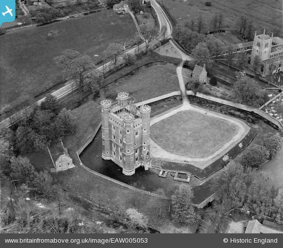
EAW005053 ENGLAND (1947). Tattershall Castle, Tattershall, 1947
© Copyright OpenStreetMap contributors and licensed by the OpenStreetMap Foundation. 2026. Cartography is licensed as CC BY-SA.
Nearby Images (16)
EAW005053

EAW005048

EAW005049

EAW005050

EAW035008

EAW035005

EAW035007

EAW035006

EAW035011

EAW035010

EAW035009

EAW005051

EAW005047

EAW005052

EAW013971

EAW013972

Details
| Title | [EAW005053] Tattershall Castle, Tattershall, 1947 |
| Reference | EAW005053 |
| Date | 8-May-1947 |
| Link | |
| Place name | TATTERSHALL |
| Parish | TATTERSHALL |
| District | |
| Country | ENGLAND |
| Easting / Northing | 521058, 357533 |
| Longitude / Latitude | -0.1916580492219, 53.100947727901 |
| National Grid Reference | TF211575 |
Pins

totoro |
Friday 11th of October 2013 05:36:50 PM | |
|
totoro |
Friday 11th of October 2013 05:33:25 PM | |
|
totoro |
Friday 11th of October 2013 05:32:15 PM | |
|
totoro |
Friday 11th of October 2013 05:30:00 PM | |
|
totoro |
Friday 11th of October 2013 05:26:07 PM | |
|
totoro |
Friday 11th of October 2013 05:16:05 PM |