
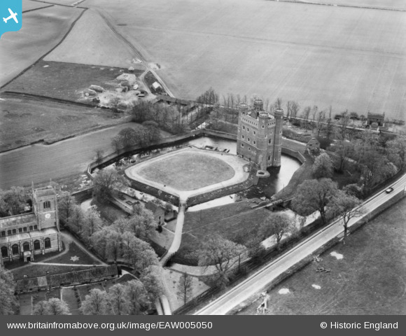
EAW005050 ENGLAND (1947). Tattershall Castle, Tattershall, 1947. This image has been produced from a print.
© Copyright OpenStreetMap contributors and licensed by the OpenStreetMap Foundation. 2026. Cartography is licensed as CC BY-SA.
Nearby Images (16)
EAW005050

EAW005049

EAW005053

EAW035005

EAW035011

EAW005048

EAW035007

EAW035006

EAW035010

EAW035008

EAW035009

EAW005051

EAW005052

EAW005047

EAW013971

EAW013972

Details
| Title | [EAW005050] Tattershall Castle, Tattershall, 1947. This image has been produced from a print. |
| Reference | EAW005050 |
| Date | 8-May-1947 |
| Link | |
| Place name | TATTERSHALL |
| Parish | TATTERSHALL |
| District | |
| Country | ENGLAND |
| Easting / Northing | 521079, 357532 |
| Longitude / Latitude | -0.19134490302105, 53.100933977681 |
| National Grid Reference | TF211575 |
Pins
Be the first to add a comment to this image!