
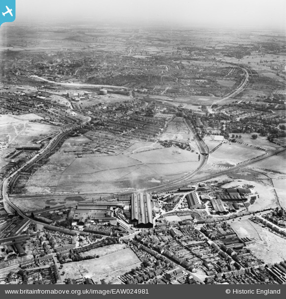
EAW024981 ENGLAND (1949). The F. H. Lloyd and Co James Bridge Steel Works and the surrounding area, Darlaston, from the west, 1949. This image was marked by Aerofilms Ltd for photo editing.
© Copyright OpenStreetMap contributors and licensed by the OpenStreetMap Foundation. 2026. Cartography is licensed as CC BY-SA.
Nearby Images (34)
EAW024981

EAW000947

EAW000945

EAW042211

EAW000949

EPW057525

EPW057524

EAW000951

EPW057527

EAW000952

EAW042207

EPW057531

EAW000948

EAW024970

EPW057529

EAW042206

EPW057528

EAW024971

EAW042218

EAW000946

EPW057526

EAW042219

EAW024979

EAW000950

EAW024972

EAW042216

EPW057530

EAW042209

EAW024978

EAW024983

EAW042212

EAW042215

EAW042217

EAW024973

Details
| Title | [EAW024981] The F. H. Lloyd and Co James Bridge Steel Works and the surrounding area, Darlaston, from the west, 1949. This image was marked by Aerofilms Ltd for photo editing. |
| Reference | EAW024981 |
| Date | 21-July-1949 |
| Link | |
| Place name | DARLASTON |
| Parish | |
| District | |
| Country | ENGLAND |
| Easting / Northing | 398809, 297072 |
| Longitude / Latitude | -2.0175749332206, 52.571110777639 |
| National Grid Reference | SO988971 |
Pins

kevofbrum |
Monday 7th of September 2015 11:01:28 PM | |
|
KevTheBusDriver |
Sunday 28th of June 2015 08:00:11 PM |