
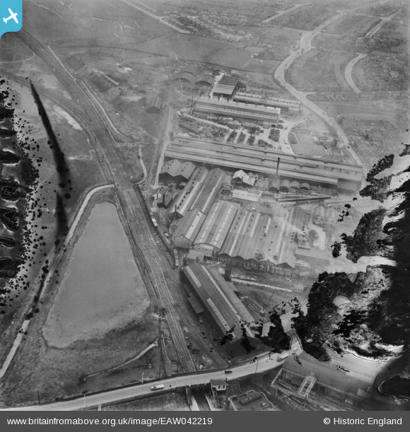
EAW042219 ENGLAND (1952). F. H. Lloyd & Co James Bridge Steel Works, Darlaston, 1952. This image has been produced from a damaged negative.
© Copyright OpenStreetMap contributors and licensed by the OpenStreetMap Foundation. 2026. Cartography is licensed as CC BY-SA.
Nearby Images (34)
EAW042219

EAW000946

EPW057528

EAW042207

EPW057529

EPW057530

EAW042209

EPW057531

EAW000952

EAW042216

EAW000948

EPW057527

EAW042212

EAW042206

EPW057525

EAW000950

EPW057524

EAW042215

EAW000951

EAW042217

EAW000945

EAW024970

EAW000949

EAW000947

EAW042211

EAW024972

EAW024971

EAW024981

EAW042218

EPW057526

EAW024983

EAW024976

EAW024975

EAW024974

Details
| Title | [EAW042219] F. H. Lloyd & Co James Bridge Steel Works, Darlaston, 1952. This image has been produced from a damaged negative. |
| Reference | EAW042219 |
| Date | 3-April-1952 |
| Link | |
| Place name | DARLASTON |
| Parish | |
| District | |
| Country | ENGLAND |
| Easting / Northing | 398914, 297196 |
| Longitude / Latitude | -2.0160259123585, 52.572225865053 |
| National Grid Reference | SO989972 |
Pins
Be the first to add a comment to this image!