
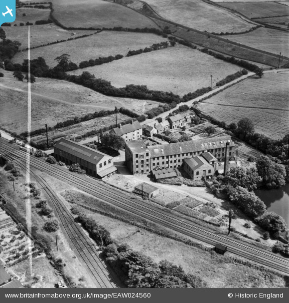
EAW024560 ENGLAND (1949). The Hermitage Hosiery Mill, Mansfield, 1949. This image was marked by Aerofilms Ltd for photo editing.
© Copyright OpenStreetMap contributors and licensed by the OpenStreetMap Foundation. 2026. Cartography is licensed as CC BY-SA.
Nearby Images (9)
EAW024560

EAW024566

EAW024562

EAW024561

EAW024563

EAW024564

EAW024558

EAW024559

EAW024565

Details
| Title | [EAW024560] The Hermitage Hosiery Mill, Mansfield, 1949. This image was marked by Aerofilms Ltd for photo editing. |
| Reference | EAW024560 |
| Date | 8-July-1949 |
| Link | |
| Place name | MANSFIELD |
| Parish | |
| District | |
| Country | ENGLAND |
| Easting / Northing | 452404, 359899 |
| Longitude / Latitude | -1.216638863214, 53.133377801506 |
| National Grid Reference | SK524599 |
Pins

Wak |
Saturday 28th of December 2013 07:25:29 PM |
User Comment Contributions
Mill appears disused |
MB |
Wednesday 12th of October 2016 05:37:56 PM |